
Topografische Karte Bhatpara
Interaktive Karte
Klicken Sie auf die Karte, um die Höhe anzuzeigen.
Über diese Karte
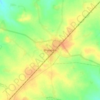
Name: Topografische Karte Bhatpara, Höhe, Relief.
Ort: Bhatpara, Bhatapara Tahsil, Baloda Bazar, Chhattisgarh, India (21.69535 81.90446 21.77535 81.98446)
Durchschnittliche Höhe: 264 m
Minimale Höhe: 245 m
Maximale Höhe: 278 m
Bhatpara is located at 22°52′N 88°25′E / 22.87°N 88.41°E / 22.87; 88.41. It has an average elevation of 12 metres (39 feet). The main town is sandwiched between the Hoogly river in the west and railway track linking Sealdah and Krishnanagar in the east.