
Topografische Karte Mount Forest
Interaktive Karte
Klicken Sie auf die Karte, um die Höhe anzuzeigen.
Über diese Karte
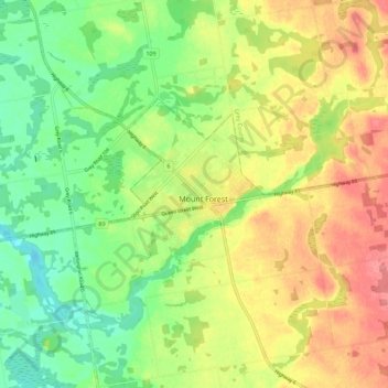
Name: Topografische Karte Mount Forest, Höhe, Relief.
Durchschnittliche Höhe: 417 m
Minimale Höhe: 380 m
Maximale Höhe: 456 m
Andere topografische Karten
Klicken Sie auf eine Karte, um ihre Topografie, ihre Höhe und ihr Relief anzuzeigen.
Conn
Canada > Ontario > Wellington County > Wellington North
Conn, Wellington North, Wellington County, Southwestern Ontario, Ontario, Canada
Durchschnittliche Höhe: 475 m
Luther Lake
Canada > Ontario > Wellington County > Wellington North
Luther Lake, Wellington North, Wellington County, Southwestern Ontario, Ontario, Canada
Durchschnittliche Höhe: 482 m