
Topografische Karte Okotoks
Interaktive Karte
Klicken Sie auf die Karte, um die Höhe anzuzeigen.
Über diese Karte
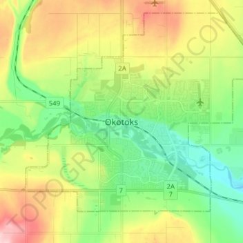
Name: Topografische Karte Okotoks, Höhe, Relief.
Ort: Okotoks, Town of Okotoks, Alberta, T1S 2N7, Canada (50.68537 -114.01508 50.76537 -113.93508)
Durchschnittliche Höhe: 1.096 m
Minimale Höhe: 1.026 m
Maximale Höhe: 1.209 m