
Topografische Karte Lake Burley Griffin
Interaktive Karte
Klicken Sie auf die Karte, um die Höhe anzuzeigen.
Lake Burley Griffin
Charles Robert Scrivener (1855–1923) recommended the site for Canberra in 1909, which was to be a planned capital city for the country. One of the reasons for the location's selection was its ability to store water "for ornamental purposes at reasonable cost"; Scrivener's work had demonstrated that the topography could be used to create a lake through flooding.
Über diese Karte
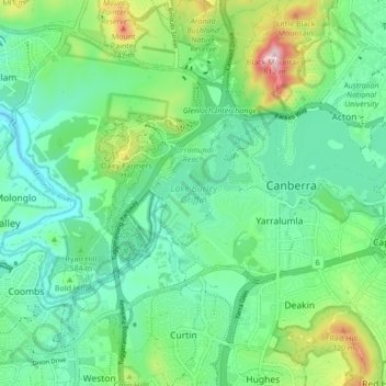
Name: Topografische Karte Lake Burley Griffin, Höhe, Relief.
Durchschnittliche Höhe: 589 m
Minimale Höhe: 508 m
Maximale Höhe: 811 m
Andere topografische Karten
Klicken Sie auf eine Karte, um ihre Topografie, ihre Höhe und ihr Relief anzuzeigen.