
Topografische Karte KNG Pudur Pirivu
Interaktive Karte
Klicken Sie auf die Karte, um die Höhe anzuzeigen.
Über diese Karte
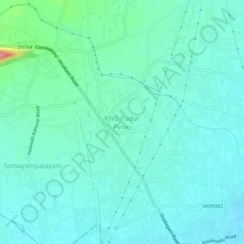
Name: Topografische Karte KNG Pudur Pirivu, Höhe, Relief.
Durchschnittliche Höhe: 462 m
Minimale Höhe: 439 m
Maximale Höhe: 576 m
Andere topografische Karten
Klicken Sie auf eine Karte, um ihre Topografie, ihre Höhe und ihr Relief anzuzeigen.
Anaikatti
India > Tamil Nadu > Coimbatore North
Anaikatti, Mannarkad, Palakkad District, Kerala, 678741, India
Durchschnittliche Höhe: 623 m
Coimbatore
India > Tamil Nadu > Coimbatore North
Coimbatore, Coimbatore North, Coimbatore District, Tamil Nadu, 641001, India
Durchschnittliche Höhe: 452 m
Somayampalayam
India > Tamil Nadu > Coimbatore North
Somayampalayam, Coimbatore North, Coimbatore District, Tamil Nadu, 641041, India
Durchschnittliche Höhe: 471 m
Karyampalayam
India > Tamil Nadu > Coimbatore North
Karyampalayam, Coimbatore North, Coimbatore District, Tamil Nadu, 638653, India
Durchschnittliche Höhe: 390 m
Athipalayam
India > Tamil Nadu > Coimbatore North
Athipalayam, Coimbatore North, Coimbatore District, Tamil Nadu, 641020, India
Durchschnittliche Höhe: 414 m
Krishnampathi Lake
India > Tamil Nadu > Coimbatore North > Coimbatore
Krishnampathi Lake, Ward 20, West Zone, Coimbatore, Coimbatore North, Coimbatore District, Tamil Nadu, 641001, India
Durchschnittliche Höhe: 425 m
Sanganoor Stream
India > Tamil Nadu > Coimbatore North > Coimbatore
Sanganoor Stream, Ward 70, Central Zone, Coimbatore, Coimbatore North, Coimbatore District, Tamil Nadu, 641001, India
Durchschnittliche Höhe: 404 m
Chinnavedampatti
India > Tamil Nadu > Coimbatore North > Chinnavedampatti
Chinnavedampatti, Coimbatore North, Coimbatore District, Tamil Nadu, 641049, India
Durchschnittliche Höhe: 428 m
Annur
India > Tamil Nadu > Coimbatore North
Annur, Coimbatore North, Coimbatore District, Tamil Nadu, 638653, India
Durchschnittliche Höhe: 381 m
Ward 34
India > Tamil Nadu > Coimbatore North > Kalapatti
Ward 34, East Zone, Kalapatti, Coimbatore North, Coimbatore District, Tamil Nadu, India
Durchschnittliche Höhe: 396 m
Kovilpalayam
India > Tamil Nadu > Coimbatore North
Kovilpalayam, Coimbatore North, Coimbatore District, Tamil Nadu, 641107, India
Durchschnittliche Höhe: 391 m
Ward 54
India > Tamil Nadu > Coimbatore North
Ward 54, Central Zone, Coimbatore North, Coimbatore District, Tamil Nadu, 641009, India
Durchschnittliche Höhe: 424 m
Kalapatti
India > Tamil Nadu > Coimbatore North
Kalapatti, Coimbatore North, Coimbatore District, Tamil Nadu, 641048, India
Durchschnittliche Höhe: 402 m
Veerapandi Pirivu
India > Tamil Nadu > Coimbatore North
Veerapandi Pirivu, Coimbatore North, Coimbatore District, Tamil Nadu, 641047, India
Durchschnittliche Höhe: 417 m
Villangkurichi
India > Tamil Nadu > Coimbatore North
Villangkurichi, Coimbatore North, Coimbatore District, Tamil Nadu, 641035, India
Durchschnittliche Höhe: 414 m
Keeranatham
India > Tamil Nadu > Coimbatore North
Keeranatham, Coimbatore North, Coimbatore District, Tamil Nadu, 641035, India
Durchschnittliche Höhe: 413 m