
Topografische Karte Howard Gap
Interaktive Karte
Klicken Sie auf die Karte, um die Höhe anzuzeigen.
Über diese Karte
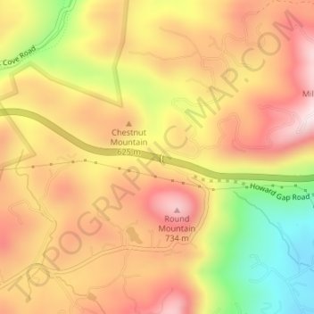
Name: Topografische Karte Howard Gap, Höhe, Relief.
Ort: Howard Gap, Polk County, North Carolina, United States (35.24937 -82.27499 35.24947 -82.27489)
Durchschnittliche Höhe: 573 m
Minimale Höhe: 326 m
Maximale Höhe: 745 m
Andere topografische Karten
Klicken Sie auf eine Karte, um ihre Topografie, ihre Höhe und ihr Relief anzuzeigen.
Peniel
United States > North Carolina > Polk County
Peniel, Polk County, North Carolina, 28722, United States
Durchschnittliche Höhe: 326 m
Saluda
United States > North Carolina > Polk County
Saluda, Polk County, North Carolina, 28773, United States
Durchschnittliche Höhe: 635 m
Tryon
United States > North Carolina > Polk County
Tryon, Polk County, North Carolina, United States
Durchschnittliche Höhe: 333 m