Geolokalisieren

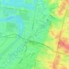
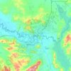
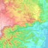
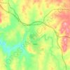
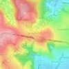
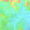
Topografische Karte Rawdon Island

Klicken Sie auf die Karte, um die Höhe anzuzeigen.

Über diese Karte

Name: Topografische Karte Rawdon Island, Höhe, Relief.

Ort: Rawdon Island, Port Macquarie-Hastings Council, New South Wales, Australia (-31.43856 152.75659 -31.40934 152.80808)

Durchschnittliche Höhe: 4 m

Minimale Höhe: -4 m

Maximale Höhe: 49 m

Andere topografische Karten

Klicken Sie auf eine Karte, um ihre Topografie, ihre Höhe und ihr Relief anzuzeigen.
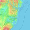
Sydney

Australia > New South Wales

Sydney's topography is characterized by a diverse landscape that seamlessly blends coastal features with inland plateaus. The city is divided into two primary regions: the relatively flat Cumberland Plain to the south and west of Sydney Harbour, and the elevated Hornsby Plateau to the north. The Cumberland…

Durchschnittliche Höhe: 51 m
Newcastle

Australia > New South Wales > Newcastle

Durchschnittliche Höhe: 5 m

Penrith

Australia > New South Wales > Sydney > Penrith

Penrith is a city in New South Wales, Australia, located in Greater Western Sydney, 55 kilometres (31 mi) west of the Sydney central business district on the banks of the Nepean River, on the outskirts of the Cumberland Plain. Its elevation is 32 metres (105 ft).

Durchschnittliche Höhe: 34 m

Shoalhaven City Council

Australia > New South Wales

Durchschnittliche Höhe: 272 m

Sydney

Australia > New South Wales

Phillip had been given no instructions for urban development, but in July 1788 submitted a plan for the new town at Sydney Cove. It included a wide central avenue, a permanent Government House, law courts, hospital and other public buildings, but no provision for warehouses, shops, or other commercial…

Durchschnittliche Höhe: 32 m
Lismore City Council

Australia > New South Wales

Durchschnittliche Höhe: 83 m

Port Macquarie

Australia > New South Wales

Durchschnittliche Höhe: 5 m

Cooranbong

Australia > New South Wales

Durchschnittliche Höhe: 72 m

Gaanha-bula–Mount Canobolas

Australia > New South Wales

With an elevation of 1,390 metres (4,560 ft) above sea level, Mount Canobolas, an extinct volcano, is the highest mountain in the region. Situated 13 kilometres (8.1 mi) southwest of the city of Orange, it is about 250 kilometres (155 mi) west of Sydney.

Durchschnittliche Höhe: 1.186 m

Leeton

Australia > New South Wales

Durchschnittliche Höhe: 156 m

Ulladulla

Australia > New South Wales > Ulladulla

Durchschnittliche Höhe: 14 m

Sydney

Australia > New South Wales > Sydney

Durchschnittliche Höhe: 23 m

Newcastle City Council

Australia > New South Wales

Durchschnittliche Höhe: 18 m

Curramore

Australia > New South Wales

Durchschnittliche Höhe: 143 m

Barrington Tops

Australia > New South Wales

Durchschnittliche Höhe: 1.107 m

Manning River

Australia > New South Wales

Durchschnittliche Höhe: 338 m

Mangrove Creek

Australia > New South Wales

Durchschnittliche Höhe: 144 m

Gerringong

Australia > New South Wales

Durchschnittliche Höhe: 37 m

Grafton

Australia > New South Wales > Grafton

Durchschnittliche Höhe: 5 m

North Ryde

Australia > New South Wales > Sydney

Durchschnittliche Höhe: 52 m

Kyogle Council

Australia > New South Wales

Durchschnittliche Höhe: 315 m

Blue Mountains

Australia > New South Wales

Durchschnittliche Höhe: 723 m

Orange

Australia > New South Wales

Orange is a city in the Central Tablelands region of New South Wales, Australia. It is 254 km (158 mi) west of the state capital, Sydney [206 km (128 mi) on a great circle], at an altitude of 862 metres (2,828 ft). Orange had an estimated urban population of 40,493 as of June 2018 making the city a significant…

Durchschnittliche Höhe: 852 m

Cooma

Australia > New South Wales

Durchschnittliche Höhe: 869 m

Albury

Australia > New South Wales

Durchschnittliche Höhe: 246 m

Goulburn

Australia > New South Wales

Owing to its elevation, Goulburn has an oceanic climate (Cfb) with warm summers and cool winters; with a high diurnal range. Its climate is variable much of the year, though generally dry with maximum temperatures ranging from 11.8 °C (53.2 °F) in July to 28.3 °C (82.9 °F) in January. Rainfall is…

Durchschnittliche Höhe: 666 m
Tweed Heads

Australia > New South Wales

Durchschnittliche Höhe: 3 m

Lower Portland

Australia > New South Wales

Durchschnittliche Höhe: 67 m

Burringbar

Australia > New South Wales

Durchschnittliche Höhe: 81 m

Tamworth

Australia > New South Wales

Durchschnittliche Höhe: 489 m

Isabella

Australia > New South Wales

Durchschnittliche Höhe: 1.070 m

Bagotville

Australia > New South Wales

Durchschnittliche Höhe: 14 m

City of Lake Macquarie

Australia > New South Wales

Durchschnittliche Höhe: 78 m

Dulwich Hill

Australia > New South Wales > Sydney

Durchschnittliche Höhe: 27 m

Bellingen Shire Council

Australia > New South Wales

Durchschnittliche Höhe: 480 m

Glenwood

Australia > New South Wales

Durchschnittliche Höhe: 69 m

Balranald Shire Council

Australia > New South Wales

Durchschnittliche Höhe: 76 m

Guthega

Australia > New South Wales

Durchschnittliche Höhe: 1.743 m

West Wyalong

Australia > New South Wales

Durchschnittliche Höhe: 257 m

Cessnock

Australia > New South Wales

Durchschnittliche Höhe: 142 m

Culburra Beach

Australia > New South Wales

Durchschnittliche Höhe: 5 m

Matong

Australia > New South Wales

Durchschnittliche Höhe: 178 m

Little Billabong

Australia > New South Wales

Durchschnittliche Höhe: 417 m

Liston

Australia > New South Wales

Durchschnittliche Höhe: 855 m

Upper Macdonald

Australia > New South Wales

Durchschnittliche Höhe: 136 m

Uriarra

Australia > New South Wales

Durchschnittliche Höhe: 808 m

Delegate

Australia > New South Wales

Durchschnittliche Höhe: 841 m

Long Jetty

Australia > New South Wales

Durchschnittliche Höhe: 9 m

Coffs Harbour City Council

Australia > New South Wales

Durchschnittliche Höhe: 207 m

Glebe

Australia > New South Wales > Sydney

Durchschnittliche Höhe: 18 m

Taree

Australia > New South Wales

Durchschnittliche Höhe: 17 m

Coonabarabran

Australia > New South Wales > Coonabarabran

Durchschnittliche Höhe: 556 m

Emu Plains

Australia > New South Wales > Penrith

Durchschnittliche Höhe: 27 m

Gundagai

Australia > New South Wales > Gundagai

Durchschnittliche Höhe: 284 m

Harrington

Australia > New South Wales

Durchschnittliche Höhe: 3 m

Fitzroy Falls

Australia > New South Wales

Durchschnittliche Höhe: 575 m

Mollymook Beach

Australia > New South Wales

Durchschnittliche Höhe: 18 m

Uralla Shire Council

Australia > New South Wales

Durchschnittliche Höhe: 928 m

Yass

Australia > New South Wales

Yass is located 280 km south-west of Sydney, on the Hume Highway. The Yass River, which is a tributary of the Murrumbidgee River, flows through the town. Yass is 59 km from Canberra; lying at an elevation of 505 m AMSL.

Durchschnittliche Höhe: 533 m

Annandale

Australia > New South Wales > Sydney

Durchschnittliche Höhe: 24 m

Mudgee

Australia > New South Wales

Durchschnittliche Höhe: 535 m

Engadine

Australia > New South Wales > Sydney

Durchschnittliche Höhe: 121 m

South Grafton

Australia > New South Wales

Durchschnittliche Höhe: 36 m

Riverwood

Australia > New South Wales > Sydney

Durchschnittliche Höhe: 22 m

Mount Kosciuszko

Australia > New South Wales

Mount Kosciuszko is the highest summit in mainland Australia. Until 1977 it was possible to drive from Charlotte Pass to within a few metres of the summit, but in 1977 the road was closed to public motor vehicle access due to environmental concerns. The road is open from Charlotte Pass for walkers and cyclists…

Durchschnittliche Höhe: 2.035 m

North Avoca

Australia > New South Wales > Gosford

Durchschnittliche Höhe: 22 m

Obx Creek

Australia > New South Wales

Durchschnittliche Höhe: 142 m

Yagoona

Australia > New South Wales > Sydney

Durchschnittliche Höhe: 44 m

Carrington

Australia > New South Wales > Newcastle

Durchschnittliche Höhe: 3 m

Narara

Australia > New South Wales

Durchschnittliche Höhe: 55 m

Lithgow

Australia > New South Wales

Durchschnittliche Höhe: 986 m

North Arm Cove

Australia > New South Wales

Durchschnittliche Höhe: 32 m

Canterbury-Bankstown Council

Australia > New South Wales > Sydney

Within the same year 16 US fighter planes that were based at Bankstown airport flew over Canterbury racecourse at low altitude during a race meet. This was to let the Australian public, especially those of the district to know that they, their allies were there for their protection. Regardless of these events,…

Durchschnittliche Höhe: 26 m

Wardell

Australia > New South Wales

Durchschnittliche Höhe: 10 m

Sutherland Shire

Australia > New South Wales > Sydney

Durchschnittliche Höhe: 79 m

Wards River

Australia > New South Wales > Wards River

Durchschnittliche Höhe: 194 m

Wollongong

Australia > New South Wales

Durchschnittliche Höhe: 16 m

Huonbrook

Australia > New South Wales

Durchschnittliche Höhe: 441 m

Corndale

Australia > New South Wales

Durchschnittliche Höhe: 81 m

Beacon Hill

Australia > New South Wales > Sydney

Durchschnittliche Höhe: 91 m

Port Hacking

Australia > New South Wales > Sydney

Durchschnittliche Höhe: 21 m

Moruya

Australia > New South Wales

Durchschnittliche Höhe: 37 m

Parramatta

Australia > New South Wales

Durchschnittliche Höhe: 22 m

Armidale

Australia > New South Wales

Durchschnittliche Höhe: 1.036 m

Kosciuszko National Park

Australia > New South Wales

Durchschnittliche Höhe: 883 m

Terrigal

Australia > New South Wales

Durchschnittliche Höhe: 13 m

Leura

Australia > New South Wales

Leura's elevation of 985 metres (3,232 ft) AHD  leads to occasional snowfall in winter and a climate that reflects all four seasons distinctly.

Durchschnittliche Höhe: 880 m
Grafton

Australia > New South Wales

Durchschnittliche Höhe: 36 m

Maitland City Council

Australia > New South Wales

Durchschnittliche Höhe: 55 m

Blacktown City Council

Australia > New South Wales

Durchschnittliche Höhe: 47 m

Cecil Hills

Australia > New South Wales > Sydney

Durchschnittliche Höhe: 77 m

Oatley

Australia > New South Wales > Sydney

Durchschnittliche Höhe: 24 m

Hat Head

Australia > New South Wales

Durchschnittliche Höhe: 4 m

Asquith

Australia > New South Wales

Durchschnittliche Höhe: 168 m

West Pennant Hills

Australia > New South Wales

Durchschnittliche Höhe: 130 m

Hawkesbury City Council

Australia > New South Wales

Durchschnittliche Höhe: 251 m

Mount Jagungal

Australia > New South Wales

Durchschnittliche Höhe: 1.818 m

Clarence Valley Council

Australia > New South Wales

Durchschnittliche Höhe: 357 m

Rüsten Sie sich für Ihr nächstes Abenteuer:

🧤Outdoor Handschuhe - Wärmende Handschuhe mit Touchscreen-Funktion
📱Outdoor Smartphone Hülle - Schutz für Smartphone unterwegs
📸Action Cam 4K - Halten Sie Ihre Abenteuer in hoher Auflösung fest
🎒Wanderrucksack 30L - Ideale Größe für Tagesausflüge mit ergonomischem Tragesystem
🏮LED Campinglaterne - Rundum-Beleuchtung für das Zelt oder den Tisch

Als Amazon-Partner verdient diese Website an qualifizierten Käufen, ohne dass Ihnen zusätzliche Kosten entstehen.