
Topografische Karte Brian Head
Interaktive Karte
Klicken Sie auf die Karte, um die Höhe anzuzeigen.
Über diese Karte
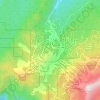
Name: Topografische Karte Brian Head, Höhe, Relief.
Ort: Brian Head, Iron County, Utah, 84719, United States (37.67687 -112.86085 37.71835 -112.81521)
Durchschnittliche Höhe: 3.031 m
Minimale Höhe: 2.729 m
Maximale Höhe: 3.449 m
The community, at an elevation of 9,800 feet (3,000 m) above sea level, is the highest town in Utah. It is located on State Route 143 and is east of Interstate 15. Brian Head is approximately three miles north of Cedar Breaks National Monument.