
Topografische Karte Kalpetta
Interaktive Karte
Klicken Sie auf die Karte, um die Höhe anzuzeigen.
Kalpetta
Kalpetta is a major town and municipality in the Wayanad district, state of Kerala, India. Kalpetta is the headquarters of Wayanad district, as well as the headquarters of Vythiri taluk. It is a bustling town surrounded by dense coffee and tea plantations and mountains. It lies on the Kozhikode-Mysore National Highway NH 766 (formerly NH 212) at an altitude of about 780 m above sea level. Kalpetta is 72 km from Kozhikode and 140 km from Mysore.
Über diese Karte
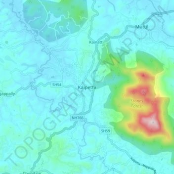
Name: Topografische Karte Kalpetta, Höhe, Relief.
Ort: Kalpetta, Vythiri, Wayanad, Kerala, 673121, India (11.57028 76.04281 11.65028 76.12281)
Durchschnittliche Höhe: 809 m
Minimale Höhe: 722 m
Maximale Höhe: 1.385 m