
Topografische Karte Krupanj
Interaktive Karte
Klicken Sie auf die Karte, um die Höhe anzuzeigen.
Krupanj
The town lies in western Serbia, at the southern border of the Pannonian plain and Mačva region. It is surrounded by the mountains Jagodnja, Boranja and Sokolska planina, in a valley intersected by several rivers and creeks. In the town itself, the rivers Bogoštica, Čađavica and Kržava conjoin into Likodra, which later empties into Jadar. The town lies at the altitude of 280 m.
Über diese Karte
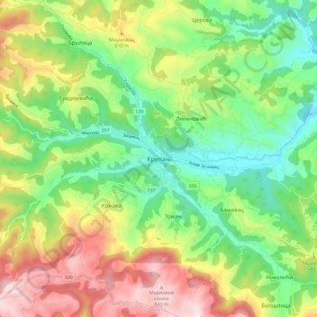
Name: Topografische Karte Krupanj, Höhe, Relief.
Durchschnittliche Höhe: 484 m
Minimale Höhe: 229 m
Maximale Höhe: 876 m