Geolokalisieren

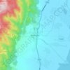
Topografische Karte Kakching

Klicken Sie auf die Karte, um die Höhe anzuzeigen.

Über diese Karte

Name: Topografische Karte Kakching, Höhe, Relief.

Ort: Kakching, Manipur, India (24.20008 93.83808 24.57776 94.05353)

Durchschnittliche Höhe: 925 m

Minimale Höhe: 703 m

Maximale Höhe: 1.897 m

Andere topografische Karten

Klicken Sie auf eine Karte, um ihre Topografie, ihre Höhe und ihr Relief anzuzeigen.

Singda Dam

India > Manipur

Durchschnittliche Höhe: 948 m

Gularthol

India > Manipur

Durchschnittliche Höhe: 46 m

Champanagar

India > Manipur

Durchschnittliche Höhe: 37 m

Imphal

India > Manipur > Lamphelpat

Durchschnittliche Höhe: 861 m

Kameng

India > Manipur > Lamsang subdivision

Durchschnittliche Höhe: 817 m

Tamenglong

India > Manipur > Tamenglong Subdivision

Durchschnittliche Höhe: 922 m

Moreh

India > Manipur > Tengnoupal tehsil

Durchschnittliche Höhe: 270 m

Noney

India > Manipur > Tamenglong

Durchschnittliche Höhe: 670 m

Pherzawl

India > Manipur > Pherzawl

Durchschnittliche Höhe: 779 m

Nambul River

India > Manipur > Imphal

Durchschnittliche Höhe: 784 m

Moirang

India > Manipur > Nambol block

Durchschnittliche Höhe: 776 m

Khuga Dam

India > Manipur > Churachandpur subdivision > Saipum

Durchschnittliche Höhe: 849 m

Manipur River

India > Manipur > Chakpikarong

Durchschnittliche Höhe: 964 m

Iril River

India > Manipur > Sawombung

Durchschnittliche Höhe: 992 m

Maram

India > Manipur > Senapati tehsil

Durchschnittliche Höhe: 1.399 m

Koubru

India > Manipur > Saitu-Gamphazol

Durchschnittliche Höhe: 2.146 m

Laikot

India > Manipur > Kangpoki

Durchschnittliche Höhe: 2.391 m

Lamshang

India > Manipur > Lamsang

Durchschnittliche Höhe: 792 m

Leimakhong

India > Manipur > Kangchup Geljang Subdivision

Durchschnittliche Höhe: 1.091 m

Shirui Kashung

India > Manipur > Ukhrul tehsil

Durchschnittliche Höhe: 2.238 m

Saipum

India > Manipur > Churachandpur subdivision

Durchschnittliche Höhe: 845 m

Khoupum

India > Manipur > Nungba subdivision

Durchschnittliche Höhe: 806 m

Kongba River

India > Manipur > Porompat

Durchschnittliche Höhe: 813 m

Sinzawl

India > Manipur > Thanlon subdivision

Durchschnittliche Höhe: 840 m

Haochong

India > Manipur > Tamenglong Subdivision

Durchschnittliche Höhe: 1.145 m

Bishnupur

India > Manipur > Bishnupur block

Durchschnittliche Höhe: 903 m

Churachandpur

India > Manipur > Churachandpur subdivision

Durchschnittliche Höhe: 919 m

Saparmeina

India > Manipur > Saitu-Gamphazol subdivision

Durchschnittliche Höhe: 1.044 m

Motbung

India > Manipur > Saikul subdivision

Durchschnittliche Höhe: 951 m

Phubala

India > Manipur > Bishnupur block

Durchschnittliche Höhe: 779 m

Karang

India > Manipur > Bishnupur block

Durchschnittliche Höhe: 771 m

Vangaichungpao - Part 2

India > Manipur > Tamenglong West

Durchschnittliche Höhe: 136 m

Irang Khun

India > Manipur > Tamenglong Subdivision

Durchschnittliche Höhe: 504 m

Thingou

India > Manipur > Nungba subdivision

Durchschnittliche Höhe: 554 m

Bolongdai

India > Manipur > Nungba subdivision

Durchschnittliche Höhe: 651 m

Chaoba Ching

India > Manipur > Bishnupur block > Thanga

Durchschnittliche Höhe: 773 m

Khumanthou Ching

India > Manipur > Saikul subdivision > Chanbirok

Durchschnittliche Höhe: 893 m

Nongmai Ching

India > Manipur > Keirao Bitra

Durchschnittliche Höhe: 1.199 m

Kamong

India > Manipur > Kasom Khullen Subdivision > K. Ashang Khullen

Durchschnittliche Höhe: 660 m

Nabil Khunou

India > Manipur > Henglep subdivision

Durchschnittliche Höhe: 1.618 m

Loiching

India > Manipur > Bungte Chiru Subdivision > Loibol Khullen

Durchschnittliche Höhe: 1.719 m

Khaoching

India > Manipur > Tamenglong West

Durchschnittliche Höhe: 981 m

Khongjang

India > Manipur > Parbung-Tipaimukh subdivision > Tinsong

Durchschnittliche Höhe: 879 m

Heibok Ching

India > Manipur > Wangoi

Durchschnittliche Höhe: 783 m

Panckibot

India > Manipur > Tamenglong Subdivision

Durchschnittliche Höhe: 1.247 m

Nungsai

India > Manipur > Henglep subdivision > Kolhen

Durchschnittliche Höhe: 1.246 m

Haobi

India > Manipur > Churachandpur subdivision

Durchschnittliche Höhe: 1.246 m

Maibam Ching

India > Manipur > Nambol Subdivision > Oinam

Durchschnittliche Höhe: 777 m
Imphal

India > Manipur > Lamphelpat

Durchschnittliche Höhe: 861 m

Motbung

India > Manipur > Saikul subdivision

Durchschnittliche Höhe: 951 m

Imphal

India > Manipur > Lamphelpat

Durchschnittliche Höhe: 861 m

Kangpokpi

India > Manipur > Kangpoki subdivision

Durchschnittliche Höhe: 1.328 m

Imphal

India > Manipur > Lamphelpat

Durchschnittliche Höhe: 861 m

Imphal River

India > Manipur > Lamsang subdivision

Durchschnittliche Höhe: 1.170 m

Koubru

India > Manipur > Saitu-Gamphazol subdivision

Durchschnittliche Höhe: 2.146 m

Kangvai

India > Manipur > Kangvai Subdivision

Durchschnittliche Höhe: 839 m

Khoupum

India > Manipur > Nungba subdivision

Durchschnittliche Höhe: 806 m

Nambul River

India > Manipur > Lamphelpat > Imphal

Durchschnittliche Höhe: 780 m

Sugnu

India > Manipur > Kakching subdivision

Durchschnittliche Höhe: 844 m

Kumbi

India > Manipur > Moirang block

Durchschnittliche Höhe: 778 m

Taphou

India > Manipur > Kangpoki subdivision

Durchschnittliche Höhe: 1.235 m

Kangpokpi

India > Manipur > Kangpoki subdivision

Durchschnittliche Höhe: 1.328 m

Rüsten Sie sich für Ihr nächstes Abenteuer:

🔌Powerbank - Externe Energie für GPS/Telefon
🧥Warme Fleecejacke - Ideale Zwischenschicht für das Zwiebelprinzip
🪑Faltbarer Campingstuhl - Leichter Sitzkomfort für die Rast
🧣Schal / Tuch - Vielseitiges Tuch für Outdoor
👕Funktionsshirt Damen - Atmungsaktives Oberteil für sportliche Aktivitäten

Als Amazon-Partner verdient diese Website an qualifizierten Käufen, ohne dass Ihnen zusätzliche Kosten entstehen.