
Topografische Karte Mount Ararat
Interaktive Karte
Klicken Sie auf die Karte, um die Höhe anzuzeigen.
Über diese Karte
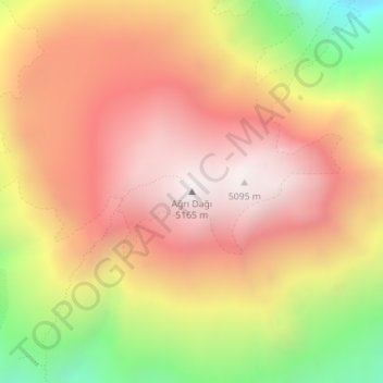
Name: Topografische Karte Mount Ararat, Höhe, Relief.
Durchschnittliche Höhe: 4.582 m
Minimale Höhe: 3.780 m
Maximale Höhe: 5.111 m
Mount Ararat is a snow-capped and dormant compound volcano in the extreme east of Turkey. It consists of two major volcanic cones: Greater Ararat and Little Ararat. Greater Ararat is the highest peak in Turkey and the Armenian Highland with an elevation of 5,137 m (16,854 ft); Little Ararat's elevation is 3,896 m (12,782 ft). The Ararat massif is about 35 km (22 mi) wide at ground base. The first recorded efforts to reach Ararat's summit were made in the Middle Ages, and Friedrich Parrot, Khachatur Abovian, and four others made the first recorded ascent in 1829.