
Topografische Karte Harar
Interaktive Karte
Klicken Sie auf die Karte, um die Höhe anzuzeigen.
Harar
Harar is the capital of the East Hararghe Zone and the capital of the Harari Region of Ethiopia. The city is located on a hilltop in the eastern extension of Oromia, about five hundred kilometers from the seat of federal Government and Oromia's capital Addis Ababa at an elevation of 1,885 metres (6,184 ft). Based on figures from the Central Statistical Agency in 2005, Harar had an estimated total population of 122,000, of whom 60,000 were male and 62,000 were female. According to the census of 1994, on which this estimate is based, the city had a population of 76,378.
Über diese Karte
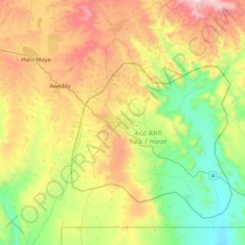
Name: Topografische Karte Harar, Höhe, Relief.
Ort: Harar, Ethiopia (9.15184 41.96844 9.47184 42.28844)
Durchschnittliche Höhe: 1.837 m
Minimale Höhe: 1.263 m
Maximale Höhe: 2.739 m