
Topografische Karte Ricabo
Interaktive Karte
Klicken Sie auf die Karte, um die Höhe anzuzeigen.
Über diese Karte
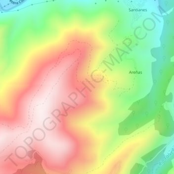
Name: Topografische Karte Ricabo, Höhe, Relief.
Ort: Ricabo, Tineo, Asturias, 33876, España (43.26653 -6.40517 43.28653 -6.38517)
Durchschnittliche Höhe: 526 m
Minimale Höhe: 216 m
Maximale Höhe: 812 m
Andere topografische Karten
Klicken Sie auf eine Karte, um ihre Topografie, ihre Höhe und ihr Relief anzuzeigen.
Pena el Caleyo
España > Asturias > Tineo > Tineo
Pena el Caleyo, Tineo, Asturias, 33870, España
Durchschnittliche Höhe: 855 m
Las Cuevas
Las Cuevas, Tineo, Asturias, 33876, España
Durchschnittliche Höhe: 473 m