
Topografische Karte Manorville
Interaktive Karte
Klicken Sie auf die Karte, um die Höhe anzuzeigen.
Über diese Karte
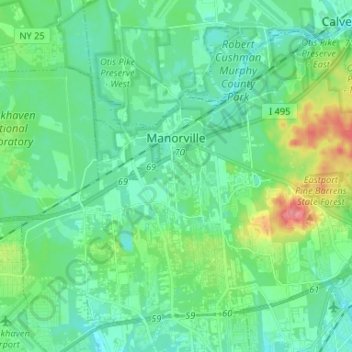
Name: Topografische Karte Manorville, Höhe, Relief.
Durchschnittliche Höhe: 22 m
Minimale Höhe: 4 m
Maximale Höhe: 80 m
Manorville is in the center of Long Island with no access to the water. It lies partially on the Ronkonkoma terminal moraine, which creates some slightly rolling topography, especially in the central portion of the hamlet. The glacial topography of the area features several kettle hole ponds, the most well-known of which is Punk's Hole, where a Revolutionary War captain was rumored to have hid from the British.
Andere topografische Karten
Klicken Sie auf eine Karte, um ihre Topografie, ihre Höhe und ihr Relief anzuzeigen.
Town of Brookhaven
United States > New York > Suffolk County > Town of Brookhaven
Town of Brookhaven, Suffolk County, New York, United States
Durchschnittliche Höhe: 10 m
Medford
United States > New York > Suffolk County > Town of Brookhaven
Medford, Town of Brookhaven, Suffolk County, New York, 11763, United States
Durchschnittliche Höhe: 35 m
East Moriches
United States > New York > Suffolk County > Town of Brookhaven > East Moriches
East Moriches, Town of Brookhaven, Suffolk County, New York, 11940, United States
Durchschnittliche Höhe: 9 m