
Topografische Karte Jimbolia
Interaktive Karte
Klicken Sie auf die Karte, um die Höhe anzuzeigen.
Über diese Karte
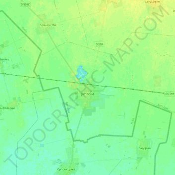
Name: Topografische Karte Jimbolia, Höhe, Relief.
Ort: Jimbolia, Timiș, 305400, Romania (45.74893 20.65092 45.84548 20.86977)
Durchschnittliche Höhe: 80 m
Minimale Höhe: 73 m
Maximale Höhe: 89 m
Jimbolia is located in the west of Timiș County, 39 km from Timișoara, with which it is connected by the county road 59A and the Kikinda–Jimbolia–Timișoara railway. It lies in the Banat Plain, at the contact between the Timiș Plain and the Mureș Plain. An alignment of villages marks the boundary between the two relief units: Checea–Cărpiniș–Satchinez. The average altitude of the town is 82 m. It is located at the intersection of some roads that connect Romania and Serbia, being also a rail and road border point at the frontier between the two countries.
Andere topografische Karten
Klicken Sie auf eine Karte, um ihre Topografie, ihre Höhe und ihr Relief anzuzeigen.
Sălciua Nouă
Sălciua Nouă, Pișchia, Timiș, 307329, Romania
Durchschnittliche Höhe: 191 m
Giarmata-Vii
Giarmata-Vii, Ghiroda, Timiș, 307201, Romania
Durchschnittliche Höhe: 100 m
Teremia Mică
Romania > Timiș > Teremia Mică
Teremia Mică, Timiș, 307407, Romania
Durchschnittliche Höhe: 80 m