
Topografische Karte Shaniko
Interaktive Karte
Klicken Sie auf die Karte, um die Höhe anzuzeigen.
Über diese Karte
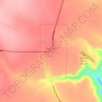
Name: Topografische Karte Shaniko, Höhe, Relief.
Ort: Shaniko, Wasco County, Oregon, United States (44.99660 -120.75733 45.01082 -120.74709)
Durchschnittliche Höhe: 1.009 m
Minimale Höhe: 900 m
Maximale Höhe: 1.038 m
The city is at an elevation of 3,343 feet (1,019 m). On the high plateau on which Shaniko was built, the soil is thin and the vegetation sparse, consisting mainly of sagebrush, bunchgrass, and occasional junipers. Many peaks of the Cascade Range, including Hood, Jefferson, Adams, St. Helens and Rainier, are visible from the city.