Geolokalisieren

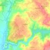
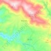
Topografische Karte Carvalhal

Klicken Sie auf die Karte, um die Höhe anzuzeigen.

Über diese Karte

Name: Topografische Karte Carvalhal, Höhe, Relief.

Ort: Carvalhal, Felgar e Souto da Velha, Torre de Moncorvo, Distrito de Bragança, 5160-081, Portugal (41.16465 -7.00107 41.20465 -6.96107)

Durchschnittliche Höhe: 678 m

Minimale Höhe: 459 m

Maximale Höhe: 905 m

Andere topografische Karten

Klicken Sie auf eine Karte, um ihre Topografie, ihre Höhe und ihr Relief anzuzeigen.
Rio Douro

Portugal > Distrito de Bragança > Torre de Moncorvo > Açoreira

Durchschnittliche Höhe: 215 m
Lousa

Portugal > Distrito de Bragança > Torre de Moncorvo

Durchschnittliche Höhe: 470 m

Carviçais

Portugal > Distrito de Bragança > Torre de Moncorvo

Durchschnittliche Höhe: 538 m

Larinho

Portugal > Distrito de Bragança > Torre de Moncorvo

Durchschnittliche Höhe: 456 m

Cardanha

Portugal > Distrito de Bragança > Torre de Moncorvo

Durchschnittliche Höhe: 407 m

Castedo

Portugal > Distrito de Bragança > Torre de Moncorvo

Durchschnittliche Höhe: 546 m

Maçores

Portugal > Distrito de Bragança > Torre de Moncorvo

Durchschnittliche Höhe: 533 m

Felgar

Portugal > Distrito de Bragança > Torre de Moncorvo

Durchschnittliche Höhe: 509 m

Rüsten Sie sich für Ihr nächstes Abenteuer:

🌦️Gamaschen für Wanderer - Schutz vor Nässe, Schlamm und Schnee in unwegsamem Gelände
🛡️Kniebandage für Wanderer - Unterstützung bei steilen Abstiegen und Gelenkproblemen
🥽Sonnenbrille UV - Schutz vor UV-Strahlen beim Bergwandern
🩹Blasenpflaster - Schutz für Füße
🧢Outdoor Mütze - Schutz vor Sonne und Kälte

Als Amazon-Partner verdient diese Website an qualifizierten Käufen, ohne dass Ihnen zusätzliche Kosten entstehen.