Geolokalisieren

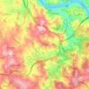
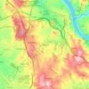
Topografische Karte Canidelo

Klicken Sie auf die Karte, um die Höhe anzuzeigen.

Über diese Karte
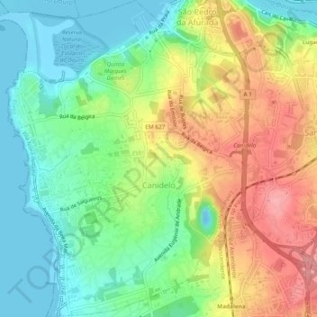
Name: Topografische Karte Canidelo, Höhe, Relief.

Ort: Canidelo, Vila Nova de Gaia, Porto, Portugal (41.10944 -8.67570 41.14482 -8.63247)

Durchschnittliche Höhe: 44 m

Minimale Höhe: -10 m

Maximale Höhe: 107 m

Andere topografische Karten

Klicken Sie auf eine Karte, um ihre Topografie, ihre Höhe und ihr Relief anzuzeigen.
Pedroso

Portugal > Porto > Vila Nova de Gaia

Durchschnittliche Höhe: 133 m

Seixezelo

Portugal > Porto > Vila Nova de Gaia

Durchschnittliche Höhe: 172 m

Devesas

Portugal > Porto > Vila Nova de Gaia

Durchschnittliche Höhe: 81 m

Afurada

Portugal > Porto > Vila Nova de Gaia

Durchschnittliche Höhe: 49 m

Sermonde

Portugal > Porto > Vila Nova de Gaia

Durchschnittliche Höhe: 138 m

Vila Nova de Gaia

Portugal > Porto > Vila Nova de Gaia

Durchschnittliche Höhe: 85 m

Carvalhos

Portugal > Porto > Vila Nova de Gaia

Durchschnittliche Höhe: 126 m

Sandim

Portugal > Porto > Vila Nova de Gaia

Durchschnittliche Höhe: 147 m

Praia Senhor da Pedra

Portugal > Porto > Vila Nova de Gaia

Durchschnittliche Höhe: 10 m

Gulpilhares

Portugal > Porto > Vila Nova de Gaia

Durchschnittliche Höhe: 51 m

Aqueduto da Serra do Pilar

Portugal > Porto > Vila Nova de Gaia

Durchschnittliche Höhe: 115 m

Crestuma

Portugal > Porto > Vila Nova de Gaia

Durchschnittliche Höhe: 110 m

Serzedo

Portugal > Porto > Vila Nova de Gaia

Durchschnittliche Höhe: 87 m

Parque Biológico de Gaia

Portugal > Porto > Vila Nova de Gaia > Avintes

Durchschnittliche Höhe: 91 m

Santo Ovídio

Portugal > Porto > Vila Nova de Gaia

Durchschnittliche Höhe: 140 m

Cais de Gaia

Portugal > Porto > Vila Nova de Gaia > Lugar do Castelo

Durchschnittliche Höhe: 67 m

São Martinho de Arnelas

Portugal > Porto > Vila Nova de Gaia

Durchschnittliche Höhe: 108 m

Afurada

Portugal > Porto > Vila Nova de Gaia

Durchschnittliche Höhe: 49 m

Rüsten Sie sich für Ihr nächstes Abenteuer:

📍GPS Geräte - Hand-GPS für Wandern, Radfahren und Orientierung
🔥Camping Gaskocher - Kompakter Kocher für die warme Mahlzeit im Freien
📻Kurbelradio für Notfälle - Informationen erhalten, auch ohne Batterien oder Netz
👕Funktionsshirt Herren - Schnelltrocknendes Shirt für schweißtreibende Aufstiege
🛡️Kniebandage für Wanderer - Unterstützung bei steilen Abstiegen und Gelenkproblemen

Als Amazon-Partner verdient diese Website an qualifizierten Käufen, ohne dass Ihnen zusätzliche Kosten entstehen.