
Topografische Karte Tanjung Balai
Interaktive Karte
Klicken Sie auf die Karte, um die Höhe anzuzeigen.
Über diese Karte
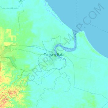
Name: Topografische Karte Tanjung Balai, Höhe, Relief.
Durchschnittliche Höhe: 5 m
Minimale Höhe: -2 m
Maximale Höhe: 39 m
Andere topografische Karten
Klicken Sie auf eine Karte, um ihre Topografie, ihre Höhe und ihr Relief anzuzeigen.
Mata Halasan
Indonesia > North Sumatra > City of Tanjung Balai
Mata Halasan, City of Tanjung Balai, North Sumatra, 21314, Indonesia
Durchschnittliche Höhe: 3 m
Keramat Kubah
Indonesia > North Sumatra > City of Tanjung Balai > Keramat Kubah
Keramat Kubah, City of Tanjung Balai, North Sumatra, 21362, Indonesia
Durchschnittliche Höhe: 3 m