

Topografische Karte Pithoragarh
Klicken Sie auf die Karte, um die Höhe anzuzeigen.
Pithoragarh
Pithoragarh is located at 29°35′N 80°13′E / 29.58°N 80.22°E / 29.58; 80.22. in the district of Pithoragarh, Uttarakhand, India. It lies in the revenue Division of Kumaon and is located 188 km northeast of Nainital, the administrative headquarters of Kumaon. It has an average elevation of 1,627 metres (5,338 feet). It is situated in the centre of the western half of the Saur Valley. The valley is spread across around 50 square kilometers. According to the Bureau of Indian Standards, on a scale ranging from I to V in order of increasing susceptibility to earthquakes, the city lies inside seismic zone V. It lies in the Moderate damage risk (B) area in Wind & Cyclone Zone and is declared a No Flood Zone.
Über diese Karte
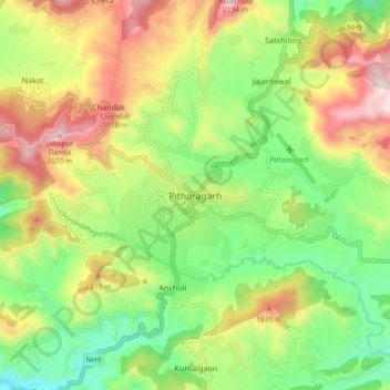
Name: Topografische Karte Pithoragarh, Höhe, Relief.
Durchschnittliche Höhe: 1.617 m
Minimale Höhe: 1.260 m
Maximale Höhe: 2.117 m