
Topografische Karte Kottathara
Klicken Sie auf die Karte, um die Höhe anzuzeigen.
Über diese Karte
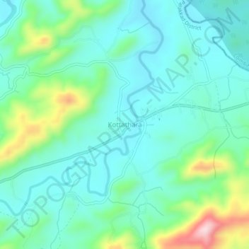
Name: Topografische Karte Kottathara, Höhe, Relief.
Ort: Kottathara, Mannarkad, Palakkad, Kerala, India (11.11288 76.66561 11.15288 76.70561)
Durchschnittliche Höhe: 549 m
Minimale Höhe: 477 m
Maximale Höhe: 784 m
Andere topografische Karten
Klicken Sie auf eine Karte, um ihre Topografie, ihre Höhe und ihr Relief anzuzeigen.