Geolokalisieren

Topografische Karte Redwood Meadows

Klicken Sie auf die Karte, um die Höhe anzuzeigen.

Über diese Karte
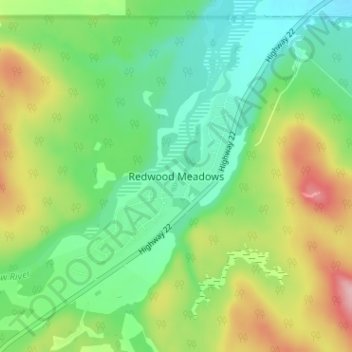
Name: Topografische Karte Redwood Meadows, Höhe, Relief.

Ort: Redwood Meadows, Rocky View County, Alberta, T3Z 2X5, Canada (50.97045 -114.52434 51.01045 -114.48434)

Durchschnittliche Höhe: 1.278 m

Minimale Höhe: 1.222 m

Maximale Höhe: 1.379 m

Andere topografische Karten

Klicken Sie auf eine Karte, um ihre Topografie, ihre Höhe und ihr Relief anzuzeigen.

Bragg Creek

Canada > Alberta > Rocky View County

Durchschnittliche Höhe: 1.326 m

Elbow River

Canada > Alberta > Rocky View County

Durchschnittliche Höhe: 1.471 m

Tsuut'ina Nation

Canada > Alberta > Rocky View County > Redwood Meadows

Durchschnittliche Höhe: 1.225 m

Calgary Crowfoot

Canada > Alberta > Rocky View County > Calgary

Durchschnittliche Höhe: 1.194 m

Harmony

Canada > Alberta > Rocky View County

Durchschnittliche Höhe: 1.191 m

Langdon

Canada > Alberta > Rocky View County

Langdon is located 12 km (7.5 mi) east of the City of Calgary at the intersection of Highway 560 (Glenmore Trail) and Highway 797, approximately 6 km (3.7 mi) south of the Trans Canada Highway and 7 km (4.3 mi) north of Highway 22X. It has an elevation of 1,005 m (3,297 ft).

Durchschnittliche Höhe: 1.007 m

Rüsten Sie sich für Ihr nächstes Abenteuer:

🥾Wanderschuhe - Robuste Wanderschuhe für Trekking und Bergtouren
🖼️3D Reliefkarte Alpen - Topografie zum Anfassen als Wanddekoration
🛏️Schlafsack - Komfortabler Schlafsack für Camping
📸Action Cam 4K - Halten Sie Ihre Abenteuer in hoher Auflösung fest
🚲Mountainbike Zubehör Set - Alles Wichtige für Wartung und Sicherheit

Als Amazon-Partner verdient diese Website an qualifizierten Käufen, ohne dass Ihnen zusätzliche Kosten entstehen.