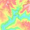
Topografische Karte Phaltan
Klicken Sie auf die Karte, um die Höhe anzuzeigen.
Über diese Karte

Name: Topografische Karte Phaltan, Höhe, Relief.
Ort: Phaltan, Satara, Maharashtra, India (17.81436 74.15432 18.10019 74.71477)
Durchschnittliche Höhe: 660 m
Minimale Höhe: 504 m
Maximale Höhe: 1.120 m
Andere topografische Karten
Klicken Sie auf eine Karte, um ihre Topografie, ihre Höhe und ihr Relief anzuzeigen.

Maharashtra
Maharashtra is the third largest state by area in India. The Western Ghats better known as Sahyadri, are a hilly range running parallel to the coast, at an average elevation of 1,200 metres (4,000 ft). Kalsubai, a peak in the Sahyadris, near Nashik city is the highest elevated point in Maharashtra. To the west…
Durchschnittliche Höhe: 478 m
Lonavala
India > Maharashtra > Mawal
Adjacent to the Lohagad fort lies the visapur fort which is part of the Lohagad-Visapur fortification. Visapur Fort is larger and at a higher elevation than its twin- Lohagad. It was built during 1713-1720 CE by Balaji Vishwanath.
Durchschnittliche Höhe: 613 m


Panvel
India > Maharashtra > Panvel > Panvel
Matheran is a hill station and a municipal council in the Raigad district in the Indian state of Maharashtra. It is a hill station in Karjat Tahsil and is also the smallest hill station in India. It is located on the Western Ghats range at an elevation of around 800 m (2,625 feet) above sea level. It is…
Durchschnittliche Höhe: 75 m
Pimpri-Chinchwad
India > Maharashtra > Haveli Subdistrict
Pimpri-Chinchwad also known as "PCMC", is a city in the Indian state of Maharashtra. The city is about 15 km (9.3 mi) northwest of the historic city of Pune, at an altitude of 590 m (1,940 ft) above sea level. It is the fifth largest city in Maharashtra and the nineteenth largest city in India and the…
Durchschnittliche Höhe: 605 m



Airoli Sector 19-20 Garden
India > Maharashtra > Thane Taluka > Navi Mumbai
Durchschnittliche Höhe: 5 m

Chamorshi
India > Maharashtra > Chamorshi Taluka
Charmoshi has an average elevation of 182 metres (600 feet).
Durchschnittliche Höhe: 194 m
Ajinkyatara Fort
India > Maharashtra > Satara > Satara
Ajinkyatara Fort, also known as the "Fort of the Sapta-Rishi," is a historical hill fort located on Ajinkyatara Mountain, one of the seven mountains surrounding the city of Satara in the Sahyadri Mountains of Maharashtra, India. Situated at an altitude of 3,300 feet, the fort overlooks Satara City and is…
Durchschnittliche Höhe: 764 m

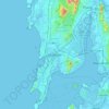
Mumbai
Mumbai lies at the mouth of the Ulhas River on the western coast of India, in the coastal region known as the Konkan. It sits on Salsette Island (Sashti Island), which it partially shares with the Thane district. Mumbai is bounded by the Arabian Sea to the west. Many parts of the city lie just above sea level,…
Durchschnittliche Höhe: 13 m
Navi Mumbai
India > Maharashtra > Thane > Navi Mumbai
Navi Mumbai (Marathi pronunciation: , also known by its former name New Bombay), is a planned city off the west coast of the Indian state of Maharashtra in Konkan division. The city is divided into two parts, North Navi Mumbai and South Navi Mumbai, for the individual development of Panvel Mega City, which…
Durchschnittliche Höhe: 30 m









Vengurla
India > Maharashtra > Vengurla Taluka
Vengurla is located at 15°52′N 73°38′E / 15.87°N 73.63°E / 15.87; 73.63. It has an average elevation of 11 metres (36 ft). Vengurla is also known as Vingoria. It includes areas such as Dabholi, Khanoli, Vetore, Tendoli, Wayangani, Surangpani, Shiroda, Redi.
Durchschnittliche Höhe: 36 m

Rahuri
India > Maharashtra > Rahuri
Rahuri is located at 19°23′N 74°39′E / 19.38°N 74.65°E / 19.38; 74.65. It has an average elevation of 511 metres (1,676 feet).
Durchschnittliche Höhe: 517 m



Nandgaon Khandeshwar
India > Maharashtra > Nandgaon-Khandeshwar > Nandgaon Khandeshwar
Durchschnittliche Höhe: 302 m

Neral
India > Maharashtra > Karjat Taluka
Neral is located at 19°02′N 73°19′E / 19.03°N 73.32°E / 19.03; 73.32. It has an average elevation of 40 metres (131 feet). Neral is a place which is the center between Mumbai and Pune, Neral has State Highway which is connecting to Karjat, NH4, Panvel and Murbad, people who visits Neral from…
Durchschnittliche Höhe: 135 m









Dahanu
India > Maharashtra > Dahanu Taluka
Dahanu is located at 19°58′N 72°44′E / 19.97°N 72.73°E / 19.97; 72.73. It has an average elevation of 9.89 metres. To the west of the town is the coast of the Arabian Sea while the east is lined with the Sahyadri ranges. This combination has made Dahanu a tourist destination. Sprawling Chickoo…
Durchschnittliche Höhe: 9 m