
Topografische Karte The Herring Pools (Low tide only)
Interaktive Karte
Klicken Sie auf die Karte, um die Höhe anzuzeigen.
Über diese Karte
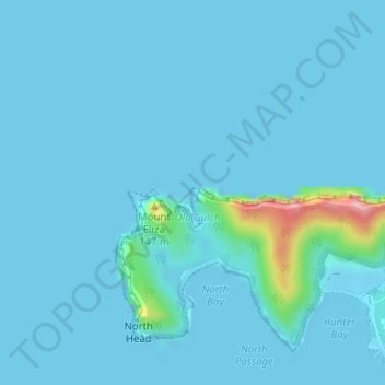
Name: Topografische Karte The Herring Pools (Low tide only), Höhe, Relief.
Durchschnittliche Höhe: 12 m
Minimale Höhe: -1 m
Maximale Höhe: 178 m
Andere topografische Karten
Klicken Sie auf eine Karte, um ihre Topografie, ihre Höhe und ihr Relief anzuzeigen.
Lord Howe Island
Australia > New South Wales > Lord Howe Island
Lord Howe Island, New South Wales, 2898, Australia
Durchschnittliche Höhe: 27 m
Mount Gower
Australia > New South Wales > Lord Howe Island
Mount Gower, Lord Howe Island, New South Wales, 2898, Australia
Durchschnittliche Höhe: 120 m