
Spenden
Rüsten Sie sich für Ihr nächstes Abenteuer:
Als Amazon-Partner verdient diese Website an qualifizierten Käufen, ohne dass Ihnen zusätzliche Kosten entstehen.
Topografische Karte Turtle Mountain Provincial Park
Klicken Sie auf die Karte, um die Höhe anzuzeigen.
Spenden
Rüsten Sie sich für Ihr nächstes Abenteuer:
Als Amazon-Partner verdient diese Website an qualifizierten Käufen, ohne dass Ihnen zusätzliche Kosten entstehen.
Turtle Mountain Provincial Park
Turtle Mountain Provincial Park is situated on the Turtle Mountain (plateau), one of a number of significant geographic features located along the Manitoba Escarpment, the Canadian portion of the Pembina Escarpment. It is located in the Southwest Manitoba Uplands Ecoregion, within the Canadian Prairies. The park is situated at an elevation of 245 metres. This region is covered by glacial till and fluvioglacial deposits, which remain from the pleistocene ice age. A study of dinoflagellates confirmed the paleocene age of the Turtle Mountain formation. Once deglaciation finished 14,000 years ago the irregular melting pattern left the area covered in hummocky terrain. The soils are mainly grey and black chernozems. There are grey luvisols at higher elevations. The bedrock in the park is composed of sandstone, shale, lignite coal. There are over 200 lakes and wetlands in this region. Many of the shorelines are covered in thick vegetation due to the littoral zone cattails. This park is home to the largest oak trees in Manitoba, which are the lone survivors of a fire that occurred in the early 20th century. Many of the water bodies are less than 15 feet deep, which often results in a winter decline in fish populations due to lack of oxygen.
Spenden
Rüsten Sie sich für Ihr nächstes Abenteuer:
Als Amazon-Partner verdient diese Website an qualifizierten Käufen, ohne dass Ihnen zusätzliche Kosten entstehen.
Über diese Karte
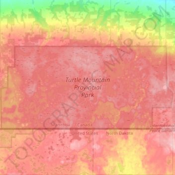
Name: Topografische Karte Turtle Mountain Provincial Park, Höhe, Relief.
Durchschnittliche Höhe: 662 m
Minimale Höhe: 563 m
Maximale Höhe: 715 m
Spenden
Rüsten Sie sich für Ihr nächstes Abenteuer:
Als Amazon-Partner verdient diese Website an qualifizierten Käufen, ohne dass Ihnen zusätzliche Kosten entstehen.
Andere topografische Karten
Klicken Sie auf eine Karte, um ihre Topografie, ihre Höhe und ihr Relief anzuzeigen.