Geolokalisieren

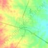
Topografische Karte Whitt

Klicken Sie auf die Karte, um die Höhe anzuzeigen.

Über diese Karte

Name: Topografische Karte Whitt, Höhe, Relief.

Ort: Whitt, Parker County, Texas, 76490, United States (32.93623 -98.03893 32.97623 -97.99893)

Durchschnittliche Höhe: 339 m

Minimale Höhe: 306 m

Maximale Höhe: 382 m

Andere topografische Karten

Klicken Sie auf eine Karte, um ihre Topografie, ihre Höhe und ihr Relief anzuzeigen.

Weatherford

United States > Texas > Parker County

Durchschnittliche Höhe: 326 m

Springtown

United States > Texas > Parker County

Durchschnittliche Höhe: 273 m

Reno

United States > Texas > Parker County

Durchschnittliche Höhe: 233 m

Aledo

United States > Texas > Parker County

Durchschnittliche Höhe: 271 m

Millsap

United States > Texas > Parker County

Durchschnittliche Höhe: 257 m

Annetta North

United States > Texas > Parker County

Durchschnittliche Höhe: 281 m

Hudson Oaks

United States > Texas > Parker County

Durchschnittliche Höhe: 298 m

Weatherford

United States > Texas > Parker County

Durchschnittliche Höhe: 326 m

Lake Weatherford

United States > Texas > Parker County > Weatherford

Durchschnittliche Höhe: 289 m

Aledo

United States > Texas > Parker County

Durchschnittliche Höhe: 271 m

Weatherford

United States > Texas > Parker County

Durchschnittliche Höhe: 326 m

Snake Forest

United States > Texas > Parker County

Durchschnittliche Höhe: 312 m

Rüsten Sie sich für Ihr nächstes Abenteuer:

🎒Wanderrucksack - Leichter und robuster Rucksack für Tagestouren
🍷Edelstahl Trinkflasche - Isoliert für heiß & kalt
🛰️GPS-Handgerät Outdoor - Präzise Navigation auch ohne Mobilfunknetz
🍽️Campinggeschirr - Geschirrset für Outdoor & Trekking
🖼️3D Reliefkarte Alpen - Topografie zum Anfassen als Wanddekoration

Als Amazon-Partner verdient diese Website an qualifizierten Käufen, ohne dass Ihnen zusätzliche Kosten entstehen.