
Topografische Karte Mountain Top
Interaktive Karte
Klicken Sie auf die Karte, um die Höhe anzuzeigen.
Über diese Karte
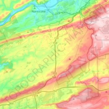
Name: Topografische Karte Mountain Top, Höhe, Relief.
Durchschnittliche Höhe: 371 m
Minimale Höhe: 150 m
Maximale Höhe: 644 m
The elevation within the Mountain Top CDP ranges from 1,070 feet (330 m) above sea level along Big Wapwallopen Creek in the southwest, to 1,860 feet (570 m) atop Nescopeck Mountain southwest of Rita, to 1,871 feet (570 m) at the east end of Penobscot Mountain in the north of the CDP. The central village of Mountain Top sits at 1,580 feet (480 m) just south of Penobscot Mountain.