
Topografische Karte Faubourg Marigny
Interaktive Karte
Klicken Sie auf die Karte, um die Höhe anzuzeigen.
Über diese Karte
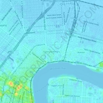
Name: Topografische Karte Faubourg Marigny, Höhe, Relief.
Durchschnittliche Höhe: 2 m
Minimale Höhe: -4 m
Maximale Höhe: 29 m
The Faubourg Marigny is located at 29°57′53″N 90°03′19″W / 29.96472°N 90.05528°W / 29.96472; -90.05528 and has an elevation of 1 foot (0.3 m). According to the United States Census Bureau, the district has a total area of 0.33 square miles (0.9 km2). 0.31 square miles (0.8 km2) of which is land and 0.02 square miles (0.1 km2) (6.06%) of which is water.