
Topografische Karte Purulia - II
Interaktive Karte
Klicken Sie auf die Karte, um die Höhe anzuzeigen.
Über diese Karte
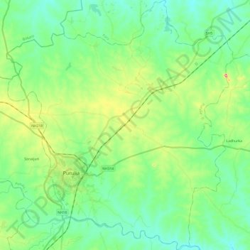
Name: Topografische Karte Purulia - II, Höhe, Relief.
Ort: Purulia - II, Puruliya, West Bengal, India (23.26134 86.30520 23.48135 86.52287)
Durchschnittliche Höhe: 230 m
Minimale Höhe: 184 m
Maximale Höhe: 354 m
The Purulia II CD block is located in the central part of the district. The Kangsabati River forms the boundary between the Purulia II and Purulia I CD blocks. The upper Kangsabati basin has undulating land and the elevation rises from 200 to 300 m and the general slope is from west to east and south-east.
Andere topografische Karten
Klicken Sie auf eine Karte, um ihre Topografie, ihre Höhe und ihr Relief anzuzeigen.
Purulia
India > West Bengal > Purulia - II
Purulia, Purulia - II, Puruliya, West Bengal, 723101, India
Durchschnittliche Höhe: 241 m