Geolokalisieren

Topografische Karte Mancombu

Interaktive Karte

Klicken Sie auf die Karte, um die Höhe anzuzeigen.

Über diese Karte

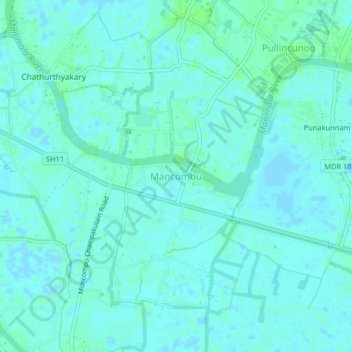
Name: Topografische Karte Mancombu, Höhe, Relief.

Ort: Mancombu, Kuttanad, Alappuzha District, Kerala, 688502, India (9.41683 76.40779 9.45683 76.44779)

Durchschnittliche Höhe: 3 m

Minimale Höhe: -3 m

Maximale Höhe: 8 m

Andere topografische Karten

Klicken Sie auf eine Karte, um ihre Topografie, ihre Höhe und ihr Relief anzuzeigen.

Champakulam

India > Kerala > Kuttanad

Champakulam, Kuttanad, Alappuzha District, Kerala, 688505, India

Durchschnittliche Höhe: 3 m

Kainakary

India > Kerala > Kuttanad

Kainakary, Kuttanad, Alappuzha District, Kerala, 688501, India

Durchschnittliche Höhe: 2 m

Veliyanadu Kidangara Ferry

India > Kerala > Kuttanad

Veliyanadu Kidangara Ferry, Kuttanad, Alappuzha, Kerala, 689595, India

Durchschnittliche Höhe: 2 m