
Topografische Karte Bates
Interaktive Karte
Klicken Sie auf die Karte, um die Höhe anzuzeigen.
Über diese Karte
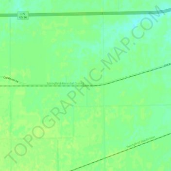
Name: Topografische Karte Bates, Höhe, Relief.
Ort: Bates, Sangamon County, Illinois, 62670, United States (39.70422 -89.86955 39.74422 -89.82955)
Durchschnittliche Höhe: 194 m
Minimale Höhe: 186 m
Maximale Höhe: 199 m
Andere topografische Karten
Klicken Sie auf eine Karte, um ihre Topografie, ihre Höhe und ihr Relief anzuzeigen.
Jerome
United States > Illinois > Sangamon County
Jerome, Sangamon County, Illinois, United States
Durchschnittliche Höhe: 185 m
Pawnee
United States > Illinois > Sangamon County
Pawnee, Sangamon County, Illinois, United States
Durchschnittliche Höhe: 183 m
Divernon
United States > Illinois > Sangamon County
Divernon, Sangamon County, Illinois, 62530, United States
Durchschnittliche Höhe: 187 m
Grandview
United States > Illinois > Sangamon County
Grandview, Sangamon County, Illinois, United States
Durchschnittliche Höhe: 183 m
Auburn
United States > Illinois > Sangamon County
Auburn, Sangamon County, Illinois, 62615, United States
Durchschnittliche Höhe: 191 m
Chatham
United States > Illinois > Sangamon County
Chatham, Sangamon County, Illinois, 62629, United States
Durchschnittliche Höhe: 183 m
Springfield
United States > Illinois > Sangamon County
Springfield, Sangamon County, Illinois, United States
Durchschnittliche Höhe: 178 m
Rochester
United States > Illinois > Sangamon County > Rochester
Rochester, Sangamon County, Illinois, United States
Durchschnittliche Höhe: 175 m
Williamsville
United States > Illinois > Sangamon County > Williamsville
Williamsville, Sangamon County, Illinois, 62693, United States
Durchschnittliche Höhe: 177 m
Buffalo
United States > Illinois > Sangamon County > Buffalo
Buffalo, Sangamon County, Illinois, United States
Durchschnittliche Höhe: 184 m
Riverton
United States > Illinois > Sangamon County
Riverton, Sangamon County, Illinois, 62651, United States
Durchschnittliche Höhe: 171 m