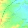
Topografische Karte Vilavancode
Klicken Sie auf die Karte, um die Höhe anzuzeigen.
Über diese Karte

Name: Topografische Karte Vilavancode, Höhe, Relief.
Ort: Vilavancode, Kanniyakumari, Tamil Nadu, India (8.18804 77.09630 8.57885 77.33424)
Durchschnittliche Höhe: 176 m
Minimale Höhe: -1 m
Maximale Höhe: 1.693 m
Andere topografische Karten
Klicken Sie auf eine Karte, um ihre Topografie, ihre Höhe und ihr Relief anzuzeigen.
Chennai
Chennai is located on the south–eastern coast of India in the north–eastern part of Tamil Nadu on a flat coastal plain known as the Eastern Coastal Plains. Its average elevation is around 6.7 metres (22 ft), and its highest point is 60 m (200 ft). Chennai is 2,184 kilometres (1,357 mi) south of Delhi,…
Durchschnittliche Höhe: 7 m
Neyveli
India > Tamil Nadu > Virudhachalam
Neyveli is located at 11°36′N 79°29′E / 11.60°N 79.48°E / 11.60; 79.48. It has an average elevation of 87 metres (285 ft). It is located along with the Chennai-Thanjavur National Highway. Neyveli was a planned township and is sub-divided into 'blocks'. There are 32 blocks with each block…
Durchschnittliche Höhe: 23 m

Tirunelveli
India > Tamil Nadu > Palayamkottai
Tirunelveli is located at 8°43′41.82″N 77°41′43.94″E / 8.7282833°N 77.6955389°E / 8.7282833; 77.6955389, and its average elevation is 47 metres (154 ft). It is located at the southernmost tip of the Deccan plateau. The Tamirabarani River divides the city into the Tirunelveli quarter and…
Durchschnittliche Höhe: 34 m
Vellore
India > Tamil Nadu > Vellore
Vellore is at 12°55′N 79°08′E / 12.92°N 79.13°E / 12.92; 79.13, 220m above sea level. The city has a tropical savanna climate. It is in the Vellore district of the South Indian state, Tamil Nadu, 135 km (84 mi) west of the state capital Chennai and 30 km (19 mi) kms South of its twin city…
Durchschnittliche Höhe: 283 m


Madurai
India > Tamil Nadu > Madurai
Madurai is located at 9°56′N 78°07′E / 9.93°N 78.12°E / 9.93; 78.12. It has an average elevation of 101 metres. The city of Madurai lies on the flat and fertile plain of the river Vaigai, which runs in the northwest-southeast direction through the city, dividing it into two almost equal…
Durchschnittliche Höhe: 138 m
Kanchipuram
Kanchipuram is located at 12°50′19″N 79°42′06″E / 12.8387°N 79.7016°E / 12.8387; 79.7016, 72 km (45 mi) south-west of Chennai on the banks of the Vegavathi River, a tributary of the Palar River. The city covers an area of 11.6 km2 (4.5 sq mi) and has an elevation of 83.2 m (273 ft) above…
Durchschnittliche Höhe: 82 m










Vengaivasal Panchayat office
India > Tamil Nadu > Tambaram > Noothanchery
Durchschnittliche Höhe: 12 m




Salem
India > Tamil Nadu > Salem
Salem is located at 11°40′N 78°08′E / 11.67°N 78.14°E / 11.67; 78.14, at an average elevation of 278 m (912 ft). The city is surrounded by hills: Nagaramalai on the north, Jarugumalai on the south, Kanjamalai on the west, Godumalai on the east and the Shevaroy Hills on the northeast.…
Durchschnittliche Höhe: 418 m
Kanyakumari
India > Tamil Nadu > Agastheeswaram
Kanniyakumari is located at 8°05′N 77°34′E / 8.08°N 77.57°E / 8.08; 77.57 and has an average elevation of 30 metres. The peninsular tip of Kanniyakumari is bordered on three sides by the Laccadive Sea. It is located at the confluence of the Western Coastal Plains and Eastern Coastal Plains.…
Durchschnittliche Höhe: 6 m
Rameswaram
India > Tamil Nadu > Rameswaram
Rameswaram has an average elevation of 10 m (33 ft). The island is spread across an area of 61.8 km2 (23.9 sq mi) and is in the shape of a conch. 74% of the area has sandy soil due to the presence of sea and it has many islands surrounding it, the Palk Strait in the north west and Gulf of Mannar in the south…
Durchschnittliche Höhe: 3 m


Kagguchi கக்குச்சி
India > Tamil Nadu > Udhagamandalam > Kagguchi கக்குச்சி
Durchschnittliche Höhe: 1.820 m

Thiruparankundram
India > Tamil Nadu > Madurai South > Madurai > Thirupparankundram
Durchschnittliche Höhe: 145 m



Yercaud
India > Tamil Nadu > Yercaud
Yercaud, also spelt Erkad, is a town and hill station in Salem District in Tamil Nadu, India. Located in Servarayan Hills in the Eastern Ghats, it is situated at an altitude of 1,515 m (4,970 ft).
Durchschnittliche Höhe: 1.092 m

Manimuthar River
India > Tamil Nadu > Nanguneri
With elevations ranging from 1,020–1,500 metres (3,350–4,920 ft), the Manjolai area is set deep in the Western Ghats within the Kalakkad Mundanthurai Tiger Reserve in Tirunelveli District. Located on top of the Manimuthar Dam and the Manimuthar waterfalls, the Manjolai area comprises tea plantations and…
Durchschnittliche Höhe: 604 m

Dindigul
India > Tamil Nadu > Dindigul
Dindugul is located at 10°21′N 77°57′E / 10.35°N 77.95°E / 10.35; 77.95 and has an average elevation of 265 m (869 ft). The town is in Dindigul district, 420 km (260 mi) from Chennai and 100 km (62 mi) south-west of Tiruchirappalli. Dindigul is located in the foothills of Sirumalai hills. The…
Durchschnittliche Höhe: 333 m



Thanjavur
India > Tamil Nadu > Thanjavur
Thanjavur is located at 10°48′N 79°09′E / 10.8°N 79.15°E / 10.8; 79.15 The tributaries of river Cauvery, namely, the Grand Anaicut canal (Pudhaaru), Vadavaaru and Vennaaru rivers flow through the city. Thanjavur is situated in the Cauvery delta, at a distance of 314 km (195 mi) south-west of…
Durchschnittliche Höhe: 49 m
Namakkal
India > Tamil Nadu > Namakkal
Namakkal is located at 11°14′N 78°10′E / 11.23°N 78.17°E / 11.23; 78.17. It has an average elevation of 218 metres or 715 feet. It is close to Kolli Hills – which are part of the Eastern Ghats. The closest significant river is the Kaveri and it is located 360 kilometres or 224 miles…
Durchschnittliche Höhe: 192 m
Tiruppur
India > Tamil Nadu > Tiruppur South
Tiruppur is located at 11°06′27″N 77°20′23″E / 11.1075°N 77.3398°E / 11.1075; 77.3398 on the banks of the Noyyal River. It has an average elevation of 295 metres (967 feet) and covers an area of 159.6 km2 (61.6 sq mi).
Durchschnittliche Höhe: 334 m
Tiruchirappalli
India > Tamil Nadu > Tiruchirappalli > Tiruchirappalli
Tiruchirappalli is situated in central south-eastern India, almost at the geographic centre of the state of Tamil Nadu. The Cauvery Delta begins to form 16 kilometres (9.9 mi) west of the city where the river divides into two streams—the Kaveri and the Kollidam—to form the island of Srirangam. By road it…
Durchschnittliche Höhe: 83 m
Pollachi
India > Tamil Nadu > Pollachi
Pollachi is located at 10°39′43″N 77°00′23″E / 10.662°N 77.0065°E / 10.662; 77.0065. It has an average elevation of 293 metres (961 ft). Aliyar river passes about 10 kilometres (6.2 mi) away from the town and the town receives rainfall from Southwest monsoon due to the presence of Palghat gap.
Durchschnittliche Höhe: 289 m
Sivakasi
India > Tamil Nadu > Sivakasi
Sivakasi is located at 9°27′00″N 77°49′00″E / 9.45°N 77.8167°E / 9.45; 77.8167 and has an average elevation of 101 metres (331 feet). The city is located in Virudhunagar district of the South Indian state, Tamil Nadu, at a distance of 74 km (46 mi) from Madurai. Sivakasi is located to the…
Durchschnittliche Höhe: 104 m

Valparai
India > Tamil Nadu > Valparai
Valparai is located at 10°22′N 76°58′E / 10.37°N 76.97°E / 10.37; 76.97. It is a mid-elevation hill station (Ootacamund is considerably higher) and has an average elevation of 3,914 feet (1,193 m). It is close to the border with Thrissur district of the Kerala state.
Durchschnittliche Höhe: 1.127 m