Geolokalisieren

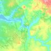
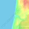
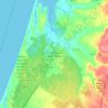
Topografische Karte Comporta

Klicken Sie auf die Karte, um die Höhe anzuzeigen.

Über diese Karte

Name: Topografische Karte Comporta, Höhe, Relief.

Ort: Comporta, Alcácer do Sal, Setúbal, Portugal (38.29443 -8.82276 38.46424 -8.64674)

Durchschnittliche Höhe: 11 m

Minimale Höhe: -1 m

Maximale Höhe: 69 m

Andere topografische Karten

Klicken Sie auf eine Karte, um ihre Topografie, ihre Höhe und ihr Relief anzuzeigen.
Quinta do Conde

Portugal > Setúbal

Durchschnittliche Höhe: 49 m

Lagoa de Albufeira

Portugal > Setúbal > Sesimbra

Durchschnittliche Höhe: 21 m

Zambujal de Cima

Portugal > Setúbal > Sesimbra

Durchschnittliche Höhe: 135 m

Setúbal

Portugal > Setúbal > Setúbal

Durchschnittliche Höhe: 32 m

Sarilhos Pequenos

Portugal > Setúbal > Moita

Durchschnittliche Höhe: 6 m

Brejos de Azeitão

Portugal > Setúbal > Setúbal

Durchschnittliche Höhe: 63 m

Funchalinho

Portugal > Setúbal > Almada

Durchschnittliche Höhe: 61 m

Picheleiros

Portugal > Setúbal > Setúbal

Durchschnittliche Höhe: 154 m

Carvalhinho

Portugal > Setúbal > Moita

Durchschnittliche Höhe: 20 m

Fidalguinhos

Portugal > Setúbal > Barreiro e Lavradio > Lavradio

Durchschnittliche Höhe: 13 m

Praia de Vale Figueiros

Portugal > Setúbal > Sines

Durchschnittliche Höhe: 13 m

Praia do Pinheirinho

Portugal > Setúbal > Grândola > Melides

Durchschnittliche Höhe: 26 m

Praia da Aberta Nova

Portugal > Setúbal > Grândola > Melides

Durchschnittliche Höhe: 20 m

Alcácer do Sal

Portugal > Setúbal

Durchschnittliche Höhe: 66 m

Entre Mar e Mar

Portugal > Setúbal > Sesimbra

Durchschnittliche Höhe: 74 m

Casais da Serra

Portugal > Setúbal > Setúbal

Durchschnittliche Höhe: 163 m

Pinheiros

Portugal > Setúbal > Seixal

Durchschnittliche Höhe: 20 m

Montijo

Portugal > Setúbal

Durchschnittliche Höhe: 28 m

Lagoa da Pedra

Portugal > Setúbal > Alcochete > São Francisco

Durchschnittliche Höhe: 12 m

Fernão Ferro

Portugal > Setúbal > Seixal

Durchschnittliche Höhe: 61 m

Vila Nova de Santo André

Portugal > Setúbal

Durchschnittliche Höhe: 71 m

Quinta do Anjo

Portugal > Setúbal > Quinta do Anjo

Durchschnittliche Höhe: 108 m

Alto do Moinho

Portugal > Setúbal > Seixal > Corroios

Durchschnittliche Höhe: 36 m

Rüsten Sie sich für Ihr nächstes Abenteuer:

Zelte - Campingzelte für 1–4 Personen
👟Trekkingsandalen Herren - Luftige Sommerschuhe für leichte Wanderwege
📱Handyhalterung Fahrrad - Smartphone sicher als Navi am Lenker nutzen
📍GPS Geräte - Hand-GPS für Wandern, Radfahren und Orientierung
🗺️Wanderkarte Luxemburg - Detaillierte Karten für das Müllerthal und Éislek

Als Amazon-Partner verdient diese Website an qualifizierten Käufen, ohne dass Ihnen zusätzliche Kosten entstehen.