
Topografische Karte Mount Arapiles
Interaktive Karte
Klicken Sie auf die Karte, um die Höhe anzuzeigen.
Über diese Karte
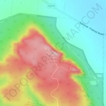
Name: Topografische Karte Mount Arapiles, Höhe, Relief.
Ort: Mount Arapiles, Rural City of Horsham, Victoria, Australia (-36.75228 141.83529 -36.75218 141.83539)
Durchschnittliche Höhe: 219 m
Minimale Höhe: 116 m
Maximale Höhe: 362 m
Andere topografische Karten
Klicken Sie auf eine Karte, um ihre Topografie, ihre Höhe und ihr Relief anzuzeigen.
Black Range State Park
Australia > Victoria > Horsham
Black Range State Park, Mount Byron Walk, Brimpaen, Horsham, Rural City of Horsham, Grampians, Victoria, Australia
Durchschnittliche Höhe: 233 m
St Helens Plains
Australia > Victoria > Horsham
St Helens Plains, Horsham, Rural City of Horsham, Grampians, Victoria, Australia
Durchschnittliche Höhe: 151 m