
Topografische Karte Aigre
Interaktive Karte
Klicken Sie auf die Karte, um die Höhe anzuzeigen.
Über diese Karte
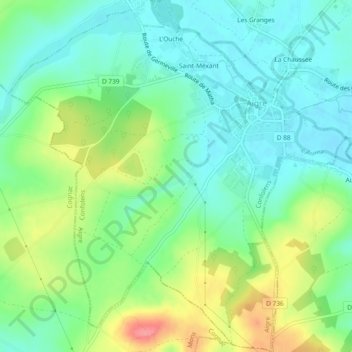
Name: Topografische Karte Aigre, Höhe, Relief.
Durchschnittliche Höhe: 90 m
Minimale Höhe: 62 m
Maximale Höhe: 146 m
The south of the commune is a plateau. The Aume Valley is near the north-eastern border near the town. The highest point of the commune is at an altitude of 129m located on the south-eastern boundary (IGN marker). The lowest point is 62m located on the eastern boundary along the Aume at Aizef. The town is built in an old loop of the river and is 65m above sea level.