
Topografische Karte Kostomłoty
Interaktive Karte
Klicken Sie auf die Karte, um die Höhe anzuzeigen.
Über diese Karte
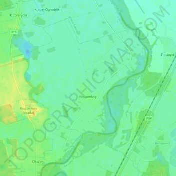
Name: Topografische Karte Kostomłoty, Höhe, Relief.
Durchschnittliche Höhe: 138 m
Minimale Höhe: 131 m
Maximale Höhe: 150 m
Andere topografische Karten
Klicken Sie auf eine Karte, um ihre Topografie, ihre Höhe und ihr Relief anzuzeigen.
Dobromyśl
Poland > Lublin Voivodeship > Biała Podlaska County
Dobromyśl, gmina Kodeń, Biała Podlaska County, Lublin Voivodeship, Poland
Durchschnittliche Höhe: 148 m
Kodeń
Poland > Lublin Voivodeship > Biała Podlaska County
Kodeń, gmina Kodeń, Biała Podlaska County, Lublin Voivodeship, Poland
Durchschnittliche Höhe: 146 m