
Topografische Karte Jijiga
Interaktive Karte
Klicken Sie auf die Karte, um die Höhe anzuzeigen.
Jijiga
Jijiga (Amharic: ጂጂጋ; Somali: Jigjiga) is a city in the Somali Region of Ethiopia. It became the capital of the Somali Regional State in 1995 after it was moved from Godey. Located in the Fafan Zone with 60 km (37 mi) west of the border with Somaliland, the city has an elevation of 1,934 metres above sea level.
Über diese Karte
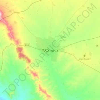
Name: Topografische Karte Jijiga, Höhe, Relief.
Ort: Jijiga, Somali Region, Ethiopia (9.19085 42.64038 9.51085 42.96038)
Durchschnittliche Höhe: 1.732 m
Minimale Höhe: 1.393 m
Maximale Höhe: 2.474 m