Topografische Karte Plan Montmin
Interaktive Karte
Klicken Sie auf die Karte, um die Höhe anzuzeigen.
Über diese Karte
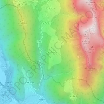
Name: Topografische Karte Plan Montmin, Höhe, Relief.
Durchschnittliche Höhe: 1.080 m
Minimale Höhe: 454 m
Maximale Höhe: 2.010 m

Klicken Sie auf die Karte, um die Höhe anzuzeigen.
Name: Topografische Karte Plan Montmin, Höhe, Relief.
Durchschnittliche Höhe: 1.080 m
Minimale Höhe: 454 m
Maximale Höhe: 2.010 m