
Topografische Karte Texas City
Interaktive Karte
Klicken Sie auf die Karte, um die Höhe anzuzeigen.
Über diese Karte
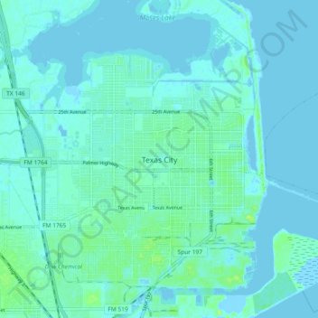
Name: Topografische Karte Texas City, Höhe, Relief.
Ort: Texas City, Galveston County, Texas, 77590, United States (29.35601 -94.95755 29.43601 -94.87755)
Durchschnittliche Höhe: 3 m
Minimale Höhe: -4 m
Maximale Höhe: 14 m
Officially, the elevation of Texas City is 10 feet above sea level, though some areas are even lower. It was naturally vulnerable to flooding by hurricane storm surges and heavy rainstorms.