
Topografische Karte Vredefort
Interaktive Karte
Klicken Sie auf die Karte, um die Höhe anzuzeigen.
Über diese Karte
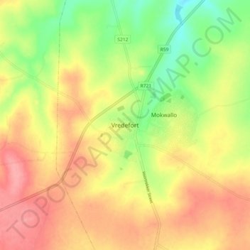
Name: Topografische Karte Vredefort, Höhe, Relief.
Durchschnittliche Höhe: 1.430 m
Minimale Höhe: 1.377 m
Maximale Höhe: 1.474 m
Andere topografische Karten
Klicken Sie auf eine Karte, um ihre Topografie, ihre Höhe und ihr Relief anzuzeigen.
Heilbron
South Africa > Free State > Fezile Dabi District Municipality > Ngwathe Local Municipality
Heilbron, Ngwathe Local Municipality, Fezile Dabi District Municipality, Free State, South Africa
Durchschnittliche Höhe: 1.559 m
Ngwathe Ward 18
South Africa > Free State > Fezile Dabi District Municipality > Ngwathe Local Municipality
Ngwathe Ward 18, Ngwathe Local Municipality, Fezile Dabi District Municipality, Free State, South Africa
Durchschnittliche Höhe: 1.443 m