Geolokalisieren

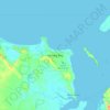
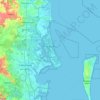
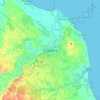
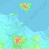
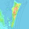
Topografische Karte Keswick Island

Klicken Sie auf die Karte, um die Höhe anzuzeigen.

Über diese Karte

Name: Topografische Karte Keswick Island, Höhe, Relief.

Ort: Keswick Island, Coral Sea, Mackay Regional, Queensland, Australia (-20.92817 149.38606 -20.89725 149.42449)

Durchschnittliche Höhe: 29 m

Minimale Höhe: -3 m

Maximale Höhe: 278 m

Andere topografische Karten

Klicken Sie auf eine Karte, um ihre Topografie, ihre Höhe und ihr Relief anzuzeigen.
Brisbane

Australia > Queensland > Brisbane

Durchschnittliche Höhe: 45 m

Toowoomba

Australia > Queensland

The city occupies the edge of the range and the low ridges behind it. Two valleys run north from the southern boundary, each arising from springs either side of Middle Ridge near Spring Street at an altitude of around 680 m. These waterways, East Creek and West Creek, flow together just north of the CBD to…

Durchschnittliche Höhe: 458 m
Gold Coast

Australia > Queensland

Durchschnittliche Höhe: 42 m

Sunshine Coast

Australia > Queensland > Sunshine Coast Regional

The Sunshine Coast in Queensland, Australia, showcases a diverse topography that harmoniously blends coastal plains with rugged hinterlands. Along its eastern edge, the region features expansive sandy beaches and coastal dunes that transition smoothly into fertile lowlands. Inland, the terrain becomes more…

Durchschnittliche Höhe: 109 m
Brisbane

Australia > Queensland

Durchschnittliche Höhe: 87 m

City of Brisbane

Australia > Queensland

Brisbane's topography is characterized by a series of hills and ranges that define its landscape. The city is situated on a low-lying floodplain, with the Brisbane River meandering through its heart, creating a winding course with many steep curves from the southwest to its mouth at Moreton Bay in the east.…

Durchschnittliche Höhe: 71 m

Urraween

Australia > Queensland > Hervey Bay

Durchschnittliche Höhe: 23 m

Tamborine Mountain

Australia > Queensland

Durchschnittliche Höhe: 447 m

Scenic Rim Regional

Australia > Queensland

Durchschnittliche Höhe: 261 m

Gympie

Australia > Queensland > Gympie

Durchschnittliche Höhe: 124 m

Hervey Bay

Australia > Queensland

Durchschnittliche Höhe: 6 m

Fig Tree Pocket

Australia > Queensland

Durchschnittliche Höhe: 20 m

Warwick

Australia > Queensland > Warwick

Warwick has a humid subtropical climate (Köppen Cfa) with hot summers and cool to cold winters. It is slightly cooler and less humid than the proximate southeast Queensland coast due to its inland, elevation location. Frost is present in winter. The climate bears similarities with Richmond, an inland suburb…

Durchschnittliche Höhe: 517 m

Mango Hill

Australia > Queensland

Durchschnittliche Höhe: 9 m

Bonogin

Australia > Queensland

Durchschnittliche Höhe: 131 m

Heathwood

Australia > Queensland

Durchschnittliche Höhe: 38 m

Mapleton

Australia > Queensland > Sunshine Coast Regional

Durchschnittliche Höhe: 337 m

Gold Coast City

Australia > Queensland

Durchschnittliche Höhe: 87 m

Burleigh Waters

Australia > Queensland > Gold Coast City

Durchschnittliche Höhe: 6 m

Mount Coot-tha

Australia > Queensland > City of Brisbane

It is often claimed that Mount Coot-tha is the "highest point in Brisbane", but, as the elevations above show, the peak known as Mount Coot-tha is not even the highest peak of the mountain as a whole with both Constitution Hill and The Summit being higher. However, Mount Coot-tha has a lookout with unobscured…

Durchschnittliche Höhe: 88 m
Port Stewart

Australia > Queensland

Durchschnittliche Höhe: 2 m

Ipswich

Australia > Queensland

Durchschnittliche Höhe: 73 m

Stanthorpe

Australia > Queensland > Stanthorpe

Owing to its elevation, Stanthorpe features a subtropical highland climate. At an altitude of 811 metres (2,661 ft), Stanthorpe holds the record for the lowest temperature recorded in Queensland at −10.6 °C (12.9 °F) on 23 June 1961. Sleet and light snowfalls are occasionally recorded, with the most…

Durchschnittliche Höhe: 840 m

Durong

Australia > Queensland

Durchschnittliche Höhe: 376 m

South Ripley

Australia > Queensland

Durchschnittliche Höhe: 117 m

Caloundra

Australia > Queensland

Caloundra, located on Queensland's Sunshine Coast, features a diverse coastal topography characterized by sandy beaches, rocky headlands, and nearby elevated terrains. The suburb of Kings Beach exemplifies this diversity, with its sandy shoreline to the south and southeast, and a rocky headland rising to about…

Durchschnittliche Höhe: 5 m

Highvale

Australia > Queensland

The area is the headwaters of the South Pine River. In the north and west of the locality the elevation rises to heights greater than 500 m above sea level along the D'Aguilar Range. Highvale is positioned at the base of Mount Nebo and Mount Glorious.

Durchschnittliche Höhe: 251 m
Cairns

Australia > Queensland

South of Smithfield and inland from the Northern Beaches along the edge of the Barron River flood plain are the suburbs of Caravonica, Kamerunga, Freshwater, and Stratford. This area is sometimes referred to as Freshwater Valley, though it is actually the lower part of Redlynch Valley; further up the valley…

Durchschnittliche Höhe: 176 m

Ingham

Australia > Queensland

Durchschnittliche Höhe: 13 m

Bribie Island

Australia > Queensland

Durchschnittliche Höhe: 44 m

Moreton Bay

Australia > Queensland

Durchschnittliche Höhe: 0 m

Byfield National Park

Australia > Queensland

Durchschnittliche Höhe: 42 m

Gladstone

Australia > Queensland

Durchschnittliche Höhe: 24 m

Highfields

Australia > Queensland

Durchschnittliche Höhe: 577 m

Lake Weyba

Australia > Queensland > Marcus Beach

Durchschnittliche Höhe: 6 m

Sunshine Coast Regional

Australia > Queensland

The Sunshine Coast Regional area in Queensland, Australia, features a diverse topography that ranges from coastal plains to rugged hinterlands. Along the coastline, the terrain is predominantly flat, with average elevations around 20 meters (66 feet) above sea level. Inland, the landscape transitions to…

Durchschnittliche Höhe: 56 m

Indooroopilly

Australia > Queensland

Durchschnittliche Höhe: 26 m

Pratten

Australia > Queensland

Durchschnittliche Höhe: 476 m

Paroo Shire

Australia > Queensland

Durchschnittliche Höhe: 199 m

Balmoral

Australia > Queensland

Durchschnittliche Höhe: 11 m

East Brisbane

Australia > Queensland

Durchschnittliche Höhe: 12 m

Mansfield

Australia > Queensland

Durchschnittliche Höhe: 33 m

Great Sandy Strait

Australia > Queensland

There are numerous named and unnamed islands in the strait. The named island are from north to south: Big Woody Island, Round Island, Little Woody Island, Picnic Island, Duck Island, Walsh Island, Turkey Island, Bookar Island, Thomas Island, Slain Island, Tooth Island, Round Bush Island, New Island, Garden…

Durchschnittliche Höhe: 28 m

Waterford West

Australia > Queensland

Durchschnittliche Höhe: 14 m

Bribie Island

Australia > Queensland > Brisbane

Bribie Island, located in Queensland, Australia, is a low-lying, elongated landmass stretching approximately 34 kilometers (21 miles) in length and up to 8 kilometers (5 miles) at its widest point. Composed predominantly of coastal sand plains, the island features two large, low-lying dunes extending…

Durchschnittliche Höhe: 6 m

Elimbah

Australia > Queensland

Durchschnittliche Höhe: 25 m

Kingaroy

Australia > Queensland

Durchschnittliche Höhe: 468 m

Murphys Creek

Australia > Queensland

Durchschnittliche Höhe: 358 m

Curtis Island

Australia > Queensland

Durchschnittliche Höhe: 21 m

Norman Creek

Australia > Queensland

Durchschnittliche Höhe: 13 m

Holloways Beach

Australia > Queensland

Durchschnittliche Höhe: 3 m

Tolga

Australia > Queensland

Durchschnittliche Höhe: 699 m

Cypress Gardens

Australia > Queensland

Durchschnittliche Höhe: 411 m

Mount Tamborine

Australia > Queensland

Durchschnittliche Höhe: 450 m

Mount Barney

Australia > Queensland

Durchschnittliche Höhe: 10 m

Atherton

Australia > Queensland

Durchschnittliche Höhe: 808 m

Mackay

Australia > Queensland

Durchschnittliche Höhe: 13 m

Innisfail

Australia > Queensland

Durchschnittliche Höhe: 12 m

Mount Ngungun

Australia > Queensland > Sunshine Coast Regional

Durchschnittliche Höhe: 49 m

Logan City

Australia > Queensland

Durchschnittliche Höhe: 61 m

Redcliffe

Australia > Queensland

Durchschnittliche Höhe: 9 m

Southern Downs Regional

Australia > Queensland

Durchschnittliche Höhe: 594 m

Sippy Downs

Australia > Queensland

Durchschnittliche Höhe: 12 m

Lockyer Valley Regional

Australia > Queensland

Durchschnittliche Höhe: 360 m

Blackall

Australia > Queensland

Durchschnittliche Höhe: 342 m

Palm Cove

Australia > Queensland

Durchschnittliche Höhe: 46 m

Kogan

Australia > Queensland

Durchschnittliche Höhe: 344 m

Baree

Australia > Queensland

Durchschnittliche Höhe: 291 m

Proston

Australia > Queensland

Durchschnittliche Höhe: 361 m

Brisbane River

Australia > Queensland

Riverfire, which began in 1998, was a festival held in September each year at South Bank Parklands and surrounding areas (including the Victoria Bridge), to celebrate the Brisbane River. In 2009, the festival merged with Brisbane Festival. Riverfire, which was held at the end of the Brisbane Festival until…

Durchschnittliche Höhe: 44 m

Rockhampton

Australia > Queensland

Durchschnittliche Höhe: 48 m

Bundaberg

Australia > Queensland

Durchschnittliche Höhe: 18 m

Mount Glorious

Australia > Queensland

Durchschnittliche Höhe: 486 m

Russell Island

Australia > Queensland

Durchschnittliche Höhe: 8 m

Mount Isa

Australia > Queensland

Durchschnittliche Höhe: 391 m

Gin Gin

Australia > Queensland > Bundaberg Region > Gin Gin

Durchschnittliche Höhe: 73 m

Esk

Australia > Queensland

Durchschnittliche Höhe: 161 m

Chinchilla

Australia > Queensland > Chinchilla

Durchschnittliche Höhe: 311 m

CDTLI Bohle Landcare site

Australia > Queensland

Durchschnittliche Höhe: 14 m

Cecil Plains

Australia > Queensland

Durchschnittliche Höhe: 373 m

Wrattens National Park

Australia > Queensland

Durchschnittliche Höhe: 362 m

Lowood

Australia > Queensland

Durchschnittliche Höhe: 80 m

Maryborough

Australia > Queensland > Maryborough

Durchschnittliche Höhe: 22 m

Woodford

Australia > Queensland > Woodford

Durchschnittliche Höhe: 142 m

Emerald

Australia > Queensland

Durchschnittliche Höhe: 181 m

Curra

Australia > Queensland > Gympie

Durchschnittliche Höhe: 67 m

Kooralbyn

Australia > Queensland

Durchschnittliche Höhe: 148 m

Magnetic Island

Australia > Queensland > Townsville

Durchschnittliche Höhe: 32 m

Townsville

Australia > Queensland

Durchschnittliche Höhe: 30 m

North Stradbroke Island

Australia > Queensland > Brisbane

Durchschnittliche Höhe: 12 m

Dimbulah

Australia > Queensland

Durchschnittliche Höhe: 580 m

Brisbane River

Australia > Queensland

The RAAF also perform a practice session in the days preceding the event, serving as an opportunity to both practice beforehand and also promote Riverfire. One of the most popular RAAF aircraft to perform at Riverfire was the F-111 which was known for performing a 'dump-and-burn' above the city. The final…

Durchschnittliche Höhe: 235 m

Irvinebank

Australia > Queensland

Durchschnittliche Höhe: 838 m

Mount Barney National Park

Australia > Queensland

Durchschnittliche Höhe: 407 m

Cunninghams Gap

Australia > Queensland > Warwick

Durchschnittliche Höhe: 781 m

Maryborough West

Australia > Queensland

Durchschnittliche Höhe: 21 m

Wivenhoe Dam

Australia > Queensland

Durchschnittliche Höhe: 62 m

Crows Nest

Australia > Queensland

Durchschnittliche Höhe: 586 m

Rüsten Sie sich für Ihr nächstes Abenteuer:

📱Outdoor Smartphone Hülle - Schutz für Smartphone unterwegs
🔋Solar Powerbank - Energie für Smartphone und GPS durch Sonnenkraft
📖Outdoor & Survival Handbuch - Wissen über Navigation und Überleben in der Natur
🧴Sonnenschutz - Sonnenschutzcreme für Outdoor
📸Action Cam 4K - Halten Sie Ihre Abenteuer in hoher Auflösung fest

Als Amazon-Partner verdient diese Website an qualifizierten Käufen, ohne dass Ihnen zusätzliche Kosten entstehen.