
Topografische Karte Atwood
Interaktive Karte
Klicken Sie auf die Karte, um die Höhe anzuzeigen.
Über diese Karte
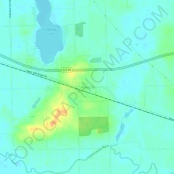
Name: Topografische Karte Atwood, Höhe, Relief.
Ort: Atwood, Kosciusko County, Indiana, 46502, United States (41.24088 -85.99527 41.28088 -85.95527)
Durchschnittliche Höhe: 246 m
Minimale Höhe: 237 m
Maximale Höhe: 276 m
Andere topografische Karten
Klicken Sie auf eine Karte, um ihre Topografie, ihre Höhe und ihr Relief anzuzeigen.
Syracuse
United States > Indiana > Kosciusko County
Syracuse, Kosciusko County, Indiana, United States
Durchschnittliche Höhe: 267 m
Pierceton
United States > Indiana > Kosciusko County
Pierceton, Kosciusko County, Indiana, United States
Durchschnittliche Höhe: 280 m
Warsaw
United States > Indiana > Kosciusko County
Warsaw, Kosciusko County, Indiana, 46580, United States
Durchschnittliche Höhe: 256 m
Tippecanoe Lake
United States > Indiana > Kosciusko County
Tippecanoe Lake, Kosciusko County, Indiana, United States
Durchschnittliche Höhe: 263 m
Winona Lake
United States > Indiana > Kosciusko County
Winona Lake, Kosciusko County, Indiana, 46590, United States
Durchschnittliche Höhe: 257 m
Warsaw
United States > Indiana > Kosciusko County > Warsaw > Warsaw
Warsaw, Kosciusko County, Indiana, 4650, United States
Durchschnittliche Höhe: 255 m
Highlands Park
United States > Indiana > Kosciusko County > Highlands Park
Highlands Park, Kosciusko County, Indiana, 46852, United States
Durchschnittliche Höhe: 262 m
Lake Wawasee
United States > Indiana > Kosciusko County > Syracuse
Lake Wawasee, Syracuse, Kosciusko County, Indiana, 46567, United States
Durchschnittliche Höhe: 267 m
Silver Point
United States > Indiana > Kosciusko County > Forest Glen
Silver Point, Forest Glen, Kosciusko County, Indiana, 46538, United States
Durchschnittliche Höhe: 264 m