Geolokalisieren
👉 Easily get elevation data in JSON, GeoTIFF and KML formats using Elevation API
Vielen Dank für die Unterstützung dieser Website ❤️
Spenden

Rüsten Sie sich für Ihr nächstes Abenteuer:

Als Amazon-Partner verdient diese Website an qualifizierten Käufen, ohne dass Ihnen zusätzliche Kosten entstehen.

Topografische Karte Lake D

Klicken Sie auf die Karte, um die Höhe anzuzeigen.

👉 Easily get elevation data in JSON, GeoTIFF and KML formats using Elevation API
Vielen Dank für die Unterstützung dieser Website ❤️
Spenden

Rüsten Sie sich für Ihr nächstes Abenteuer:

Als Amazon-Partner verdient diese Website an qualifizierten Käufen, ohne dass Ihnen zusätzliche Kosten entstehen.

Über diese Karte

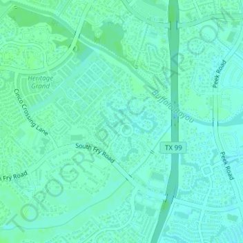
Name: Topografische Karte Lake D, Höhe, Relief.

Ort: Lake D, Avalon at Seven Meadows, Fort Bend County, Texas, United States (29.72234 -95.77975 29.72316 -95.77912)

Durchschnittliche Höhe: 35 m

Minimale Höhe: 31 m

Maximale Höhe: 38 m

👉 Easily get elevation data in JSON, GeoTIFF and KML formats using Elevation API
Vielen Dank für die Unterstützung dieser Website ❤️
Spenden

Rüsten Sie sich für Ihr nächstes Abenteuer:

Als Amazon-Partner verdient diese Website an qualifizierten Käufen, ohne dass Ihnen zusätzliche Kosten entstehen.

Andere topografische Karten

Klicken Sie auf eine Karte, um ihre Topografie, ihre Höhe und ihr Relief anzuzeigen.

Katy

United States > Texas > Fort Bend County

Durchschnittliche Höhe: 44 m

Sugar Land

United States > Texas > Fort Bend County

Sugar Land is located in northeast Fort Bend County, 20 miles (32 km) southwest of downtown Houston. It is bordered by Houston to the northeast, and by Stafford, Missouri City, and Meadows Place to the east. According to the United States Census Bureau, the city of Sugar Land has a total area of 34.0 square…

Durchschnittliche Höhe: 24 m

Fulshear

United States > Texas > Fort Bend County

Durchschnittliche Höhe: 37 m

Rosenberg

United States > Texas > Fort Bend County

Durchschnittliche Höhe: 28 m

Missouri City

United States > Texas > Fort Bend County

Durchschnittliche Höhe: 22 m

Kendleton

United States > Texas > Fort Bend County

Durchschnittliche Höhe: 31 m

Paynes

United States > Texas > Fort Bend County > Sugar Land

Durchschnittliche Höhe: 24 m

Guy

United States > Texas > Fort Bend County

Durchschnittliche Höhe: 24 m

Vielen Dank für die Unterstützung dieser Website ❤️
Spenden

Rüsten Sie sich für Ihr nächstes Abenteuer:

Als Amazon-Partner verdient diese Website an qualifizierten Käufen, ohne dass Ihnen zusätzliche Kosten entstehen.

Needville

United States > Texas > Fort Bend County

Durchschnittliche Höhe: 28 m

Oak Hill

United States > Texas > Fort Bend County

Durchschnittliche Höhe: 29 m

Stafford

United States > Texas > Fort Bend County

Durchschnittliche Höhe: 25 m

Missouri City

United States > Texas > Fort Bend County

Durchschnittliche Höhe: 22 m

Sienna

United States > Texas > Fort Bend County

Durchschnittliche Höhe: 20 m

Katy

United States > Texas > Fort Bend County > Katy > Katy

Durchschnittliche Höhe: 43 m

Katy

United States > Texas > Fort Bend County

Durchschnittliche Höhe: 44 m

Rosenberg

United States > Texas > Fort Bend County

Durchschnittliche Höhe: 28 m

Pecan Grove

United States > Texas > Fort Bend County

Durchschnittliche Höhe: 27 m

Richmond

United States > Texas > Fort Bend County

Durchschnittliche Höhe: 27 m

Missouri City

United States > Texas > Fort Bend County

Durchschnittliche Höhe: 22 m

Stafford

United States > Texas > Fort Bend County

Durchschnittliche Höhe: 25 m

Fresno

United States > Texas > Fort Bend County

Durchschnittliche Höhe: 21 m

Rosenberg

United States > Texas > Fort Bend County

Durchschnittliche Höhe: 28 m

Sugar Land

United States > Texas > Fort Bend County

Sugar Land is located in northeast Fort Bend County, 20 miles (32 km) southwest of downtown Houston. It is bordered by Houston to the northeast, and by Stafford, Missouri City, and Meadows Place to the east. According to the United States Census Bureau, the city of Sugar Land has a total area of 42.9 square…

Durchschnittliche Höhe: 24 m

Needville

United States > Texas > Fort Bend County > Needville > Needville

Durchschnittliche Höhe: 27 m

Vielen Dank für die Unterstützung dieser Website ❤️
Spenden

Rüsten Sie sich für Ihr nächstes Abenteuer:

Als Amazon-Partner verdient diese Website an qualifizierten Käufen, ohne dass Ihnen zusätzliche Kosten entstehen.

Cumings

United States > Texas > Fort Bend County > Rosenberg

Durchschnittliche Höhe: 29 m

Fulshear

United States > Texas > Fort Bend County

Durchschnittliche Höhe: 37 m

Richmond

United States > Texas > Fort Bend County > Richmond > Richmond

Durchschnittliche Höhe: 27 m

Dewalt

United States > Texas > Fort Bend County > Missouri City

Durchschnittliche Höhe: 22 m

Thompsons

United States > Texas > Fort Bend County

Durchschnittliche Höhe: 22 m

Orchard

United States > Texas > Fort Bend County

Durchschnittliche Höhe: 38 m

Rosenberg

United States > Texas > Fort Bend County

Durchschnittliche Höhe: 28 m

Trammels

United States > Texas > Fort Bend County > Missouri City > Trammels

Durchschnittliche Höhe: 22 m

Vielen Dank für die Unterstützung dieser Website ❤️
Spenden

Rüsten Sie sich für Ihr nächstes Abenteuer:

Als Amazon-Partner verdient diese Website an qualifizierten Käufen, ohne dass Ihnen zusätzliche Kosten entstehen.

Duke

United States > Texas > Fort Bend County > Arcola

Durchschnittliche Höhe: 20 m

Rüsten Sie sich für Ihr nächstes Abenteuer:

🧴Sport-Sonnencreme - Wasserfeste Sonnencreme, die nicht in den Augen brennt
🔋Solar Powerbank - Energie für Smartphone und GPS durch Sonnenkraft
🧥Hardshelljacke Damen - Wind- und wasserdichte Funktionsjacke
💾SD-Karte 128GB - Viel Speicherplatz für Fotos und topografische Daten
🛌4-Jahreszeiten Schlafsack - Wärmeisolierung auch bei Temperaturen unter Null

Als Amazon-Partner verdient diese Website an qualifizierten Käufen, ohne dass Ihnen zusätzliche Kosten entstehen.