Geolokalisieren

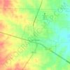
Topografische Karte Dennis

Klicken Sie auf die Karte, um die Höhe anzuzeigen.

Über diese Karte

Name: Topografische Karte Dennis, Höhe, Relief.

Ort: Dennis, Parker County, Texas, United States (32.59874 -97.94670 32.63874 -97.90670)

Durchschnittliche Höhe: 233 m

Minimale Höhe: 217 m

Maximale Höhe: 260 m

Andere topografische Karten

Klicken Sie auf eine Karte, um ihre Topografie, ihre Höhe und ihr Relief anzuzeigen.

Weatherford

United States > Texas > Parker County

Durchschnittliche Höhe: 326 m

Reno

United States > Texas > Parker County

Durchschnittliche Höhe: 233 m

Aledo

United States > Texas > Parker County

Durchschnittliche Höhe: 271 m

Springtown

United States > Texas > Parker County

Durchschnittliche Höhe: 273 m

Millsap

United States > Texas > Parker County

Durchschnittliche Höhe: 257 m

Annetta North

United States > Texas > Parker County

Durchschnittliche Höhe: 281 m

Hudson Oaks

United States > Texas > Parker County

Durchschnittliche Höhe: 298 m

Weatherford

United States > Texas > Parker County

Durchschnittliche Höhe: 326 m

Lake Weatherford

United States > Texas > Parker County > Weatherford

Durchschnittliche Höhe: 289 m

Weatherford

United States > Texas > Parker County

Durchschnittliche Höhe: 326 m

Aledo

United States > Texas > Parker County

Durchschnittliche Höhe: 271 m

Snake Forest

United States > Texas > Parker County

Durchschnittliche Höhe: 312 m

Rüsten Sie sich für Ihr nächstes Abenteuer:

🎒Rucksack Organizer - Ordnung im Rucksack
🧣Schal / Tuch - Vielseitiges Tuch für Outdoor
🥽Sonnenbrille UV - Schutz vor UV-Strahlen beim Bergwandern
👟Trail Running Schuhe - Leichte Schuhe für Gelände
🧢Outdoor Mütze - Schutz vor Sonne und Kälte

Als Amazon-Partner verdient diese Website an qualifizierten Käufen, ohne dass Ihnen zusätzliche Kosten entstehen.