Geolokalisieren

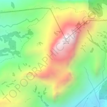
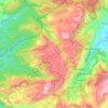
Topografische Karte Western Ghats

Klicken Sie auf die Karte, um die Höhe anzuzeigen.

Western Ghats

Geologic evidence indicates that the mountains were formed during the break-up of the supercontinent of Gondwana. The mountains came along the west coast of India somewhere in the late Jurassic and early Cretaceous periods when India separated from the African continent. The mountains can be roughly divided into three parts: the northern section with an elevation ranging from 900–1,500 m (3,000–4,900 ft), the middle section starting from the south of Goa with a lower elevation of less than 900 m (3,000 ft), and the southern section where the altitude rises again. The Western Ghats have several peaks that rise above 2,000 m (6,600 ft), with Anamudi (2,695 m (8,842 ft)) being the highest peak. The average elevation is around 1,200 m (3,900 ft).

Wikipedia (CC-BY-SA 3.0)

Über diese Karte

Name: Topografische Karte Western Ghats, Höhe, Relief.

Ort: Western Ghats, Devikulam, Idukki, Kerala, 685614, India (10.16595 77.05795 10.16605 77.05805)

Durchschnittliche Höhe: 2.225 m

Minimale Höhe: 1.828 m

Maximale Höhe: 2.685 m

Andere topografische Karten

Klicken Sie auf eine Karte, um ihre Topografie, ihre Höhe und ihr Relief anzuzeigen.

Viripara

India > Kerala > Devikulam

Durchschnittliche Höhe: 1.143 m

Pallivasal

India > Kerala > Devikulam > Pallivasal

Durchschnittliche Höhe: 1.304 m

Pothupara

India > Kerala > Devikulam > Ellakkal

Durchschnittliche Höhe: 769 m

Thalamali

India > Kerala > Devikulam > Adimali

Durchschnittliche Höhe: 885 m

Anaimudi River

India > Kerala > Devikulam

Durchschnittliche Höhe: 1.430 m

Anamalai

India > Kerala > Devikulam

Durchschnittliche Höhe: 2.023 m

Munipara

India > Kerala > Devikulam > Mankulam

Durchschnittliche Höhe: 922 m

Eravikulam National Park

India > Kerala > Devikulam > Lakkomukudi

Durchschnittliche Höhe: 1.714 m

Anamalai

India > Kerala > Devikulam

Durchschnittliche Höhe: 2.023 m

Mattupetty Dam

India > Kerala > Devikulam > Mattupetty

Durchschnittliche Höhe: 1.665 m

Rüsten Sie sich für Ihr nächstes Abenteuer:

🍷Edelstahl Trinkflasche - Isoliert für heiß & kalt
🔦Stirnlampe LED aufladbar - Freihändige Beleuchtung für Wanderungen in der Dämmerung
🧤Wanderhandschuhe - Wetterfeste Handschuhe für Outdoor
🥾Wanderstiefel - Wasserdichte Stiefel für anspruchsvolle Trails
👜Wasserdichte Fahrradtasche - Sicherer Stauraum für Bikepacking und Touren

Als Amazon-Partner verdient diese Website an qualifizierten Käufen, ohne dass Ihnen zusätzliche Kosten entstehen.