
Topografische Karte Chautauqua Lake
Interaktive Karte
Klicken Sie auf die Karte, um die Höhe anzuzeigen.
Chautauqua Lake
Chautauqua Lake, at an elevation of 1,308 feet (399 m) above sea level, is higher than any of the Finger Lakes. It is also one of the highest navigable lakes in North America. The lake's water level is regulated by Warner Dam, with the water level lifted during the summer to allow for recreational boat use and lowered during the winter months.
Über diese Karte
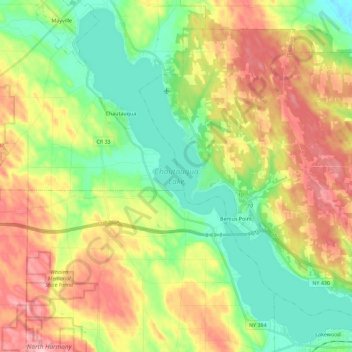
Name: Topografische Karte Chautauqua Lake, Höhe, Relief.
Durchschnittliche Höhe: 463 m
Minimale Höhe: 384 m
Maximale Höhe: 575 m