
Topografische Karte Adigrat
Interaktive Karte
Klicken Sie auf die Karte, um die Höhe anzuzeigen.
Adigrat
Adigrat (Tigrinya: ዓዲግራት, ʿaddigrat, also called ʿAddi Grat) is a city and separate woreda in the Tigray Regional State of Ethiopia. It is located in the Misraqawi Zone at longitude and latitude 14°16′N 39°27′E / 14.267°N 39.450°E / 14.267; 39.450Coordinates: 14°16′N 39°27′E / 14.267°N 39.450°E / 14.267; 39.450, with an elevation of 2,457 metres (8,061 ft) above sea level and below a high ridge to the west. Adigrat is the last important Ethiopian city south of the border with Eritrea, and is considered to be a strategically important gateway to Eritrea and the Red Sea. Adigrat was part of Ganta Afeshum woreda before a separate woreda was created for the city. Currently, Adigrat serves as the capital of the Eastern Tigray zone.
Über diese Karte
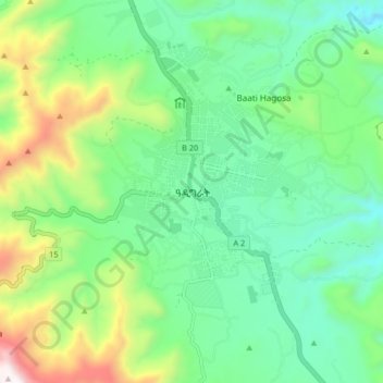
Name: Topografische Karte Adigrat, Höhe, Relief.
Ort: Adigrat, Eastern Tigray, Tigray, Ethiopia (14.23754 39.42128 14.31754 39.50128)
Durchschnittliche Höhe: 2.557 m
Minimale Höhe: 2.251 m
Maximale Höhe: 3.299 m