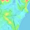
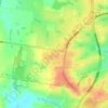
Topografische Karte Mount Pritchard
Klicken Sie auf die Karte, um die Höhe anzuzeigen.
Über diese Karte

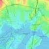
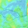
Name: Topografische Karte Mount Pritchard, Höhe, Relief.
Ort: Mount Pritchard, Sydney, New South Wales, 2170, Australia (-33.91416 150.88789 -33.89432 150.91446)
Durchschnittliche Höhe: 34 m
Minimale Höhe: 7 m
Maximale Höhe: 63 m
Andere topografische Karten
Klicken Sie auf eine Karte, um ihre Topografie, ihre Höhe und ihr Relief anzuzeigen.





























Bents Basin State Conservation Area
Australia > New South Wales > Sydney
The park is popular for swimming, kayaking, bushwalking, camping (with 100 tent sites), barbecuing, picnicking and fishing. The park also features walking trails within a bushland and an education centre with a commercial kitchen. Caley's Lookout Track, a walking track within the bushland, leads to Little…
Durchschnittliche Höhe: 82 m