
Topografische Karte Moville
Interaktive Karte
Klicken Sie auf die Karte, um die Höhe anzuzeigen.
Über diese Karte
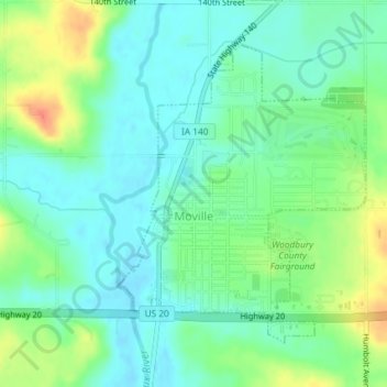
Name: Topografische Karte Moville, Höhe, Relief.
Ort: Moville, Woodbury County, Iowa, United States (42.47998 -96.07973 42.50080 -96.05617)
Durchschnittliche Höhe: 361 m
Minimale Höhe: 346 m
Maximale Höhe: 391 m
Andere topografische Karten
Klicken Sie auf eine Karte, um ihre Topografie, ihre Höhe und ihr Relief anzuzeigen.
Leeds
United States > Iowa > Woodbury County > Sioux City
Leeds, Sioux City, Woodbury County, Iowa, 51108, United States
Durchschnittliche Höhe: 362 m
Sioux City
United States > Iowa > Woodbury County
Sioux City, Woodbury County, Iowa, United States
Durchschnittliche Höhe: 352 m